-تلك الصورة النادرة يظهر بها كوبري كرموز علي ترعة المحمودية ، و التُقِطت حوالي عام 1930 م
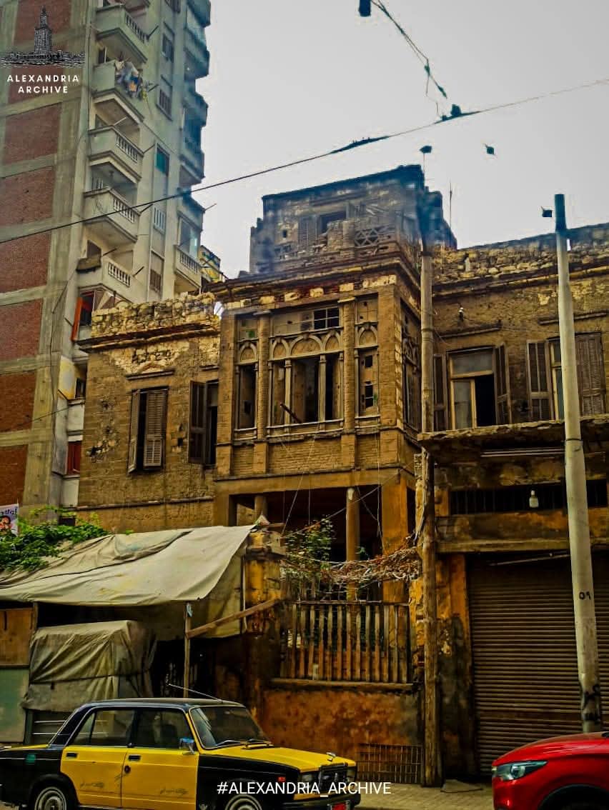
- توضح الصور فيلا قديمة بكرموز تقع عند ناصيه شارع البنيان بجوارمكتبة محروس ، عمرها غير محدد ولكن من المؤكد أنها عريقة الي حد كافٍ لتشهد علي الكثير من الاحداث التي آتي بها الزمن ، و الحكايات التي هي الآن تكمُن في خانة الذكريات لعدد محدود من الناس فقط ...
فما هي منطقة كرموز وما هو تاريخها
منطقة كرموز تعتبر واحدة من أقدم المناطق الشعبية لمدينة الإسكندرية وهي تُمثِّل أصل المدينة ومكان قرية «راكوتيس» القديمة ، و كانت المنطقة قديماً منذ عهد الرومان موضع تصميم وصناعة الفخار ،
تقع كرموز وسط مدينة الإسكندرية حيث يحدها جنوباً بحيرة مريوط ومن ناحية الشرق حي «محرم بك» المتلاصق معها ، كما يحدها من الشمال حي «اللبان» و حي «العطارين» ، و يحتوى حى كرموز على عدة مناطق اهمها «غيط العنب» و «كوم الشقافة» و «جبل ناعسة» و «الكارة» و «باب سدرة» ،
إضافة لتلك المناطق فهي يوجد بها عدة معالم سياحية اهمها « عامود السوارى» المتواجد بين هضبة كوم الشقافة و منطقة مدافن العامود «مدافن المسلمين سابقاً » فوق تل باب سيدرة مكان تل معبد السرابيوم القديم ، و انشيء خلال العصر الرومانى حوالى عام 292 م ،
كما يوجد بها «مقابر كوم الشقافة» الأثرية وترجع أيضا للعصر الرومانى بالمدينة ، و التي عُثِر عليها بطريق الصدفة البحتة في عهد الخديوى عباس حلمي الثاني يوم 28 سبتمبر عام 1900م ،
يوجد في كرموز الآن سوق من أهم اسواق الاسكندرية وهو سوق «الساعة» حيث يكثر هناك محلات بيع الاقمشة والمفروشات والملابس النسائية و يتردد عليه سكان المدينة بشكل مستمر ،
يوجد بعض الآراء حول تسمية تلك المنطقة بهذا الاسم ، و يُقال أن اسم «كرموز» هو مُشتق من «كرموس» الاسم الاصلى للمنطقة وهو اسم يونانى بمعني "التين" ، حيث كانت زراعة فاكهة التين منتشرة في هذه المنطقة حتى منطقة «رأس التين» حالياً
#alexandria_archive
#أرشيف_الإسكندرية
Karmouz area
- This rare photograph shows the Karmouz Bridge over the Mahmoudiya Canal, taken around 1930.
- The photos depict an old villa in Karmouz, located at the corner of Al-Bunyan Street, next to the Mahrous Library. Its exact age is unknown, but it is certainly old enough to have witnessed many events over time, and stories that now reside only in the memories of a few people.
So, what is the Karmouz district, and what is its history?
The Karmouz district is considered one of the oldest working-class neighborhoods in Alexandria. It represents the city's origin and the site of the ancient village of Rhakotis. Since Roman times, the area has been a center for pottery design and production.
Karmouz is located in the heart of Alexandria, bordered to the south by Lake Mariout, to the east by the adjacent Moharram Bey district, and to the north by the Al-Labban and Al-Attarin districts. The Karmouz district includes several important areas, most notably Gheit Al-Enab, Kom El-Shaqafa, and Jabal Na'asa. Karmouz and Bab Sidra
In addition to these areas, it contains several tourist attractions, most notably Pompey's Pillar, located between Kom El Shoqafa plateau and the Pillar Catacombs (formerly the Muslim cemetery) atop Bab Sidra hill, on the site of the ancient Serapeum temple. It was built during the Roman era around 292 AD.
Also located there are the ancient Kom El Shoqafa Catacombs, also dating back to the Roman period, which were discovered purely by chance during the reign of Khedive Abbas Hilmi II on September 28, 1900.
Karmouz now boasts one of Alexandria's most important markets, the Clock Market, where numerous shops sell fabrics, furnishings, and women's clothing, and which is frequented by city residents.
There are some theories about the origin of the name of this area. It is said that "Karmouz" is derived from "Karmous," the original name of the area, a Greek word meaning "fig," as fig cultivation was once widespread. In this area, up to the present-day Ras El Tin area