A comprehensive report on the Alexandria Underwater Antiquities Museum project
Alexandria Archive —
مقدمة تأسيسية
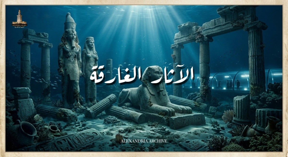
يُعد التراث الثقافي المغمور بالمياه واحداً من أعقد وأغنى السجلات التاريخية التي توثق مسيرة الحضارة الإنسانية. وفي هذا السياق، تقف مدينة الإسكندرية المصرية كواحدة من أهم الحواضر التاريخية التي تحتضن في أعماق مياهها الإقليمية إرثاً حضارياً لا يقدر بثمن، يعود إلى العصور الفرعونية، والبطلمية، والرومانية، وصولاً إلى العصور الإسلامية والحديثة. لقد أدت سلسلة متعاقبة من الكوارث الطبيعية العنيفة، والتي شملت الزلازل المدمرة، وموجات التسونامي العاتية، وظاهرة الهبوط الأرضي المستمر، وتميع التربة، إلى غرق أجزاء شاسعة من الإسكندرية القديمة والمدن الساحلية المجاورة لها، لتستقر في قاع البحر الأبيض المتوسط منذ ما يزيد عن أربعة عشر قرناً من الزمان. وقد شملت هذه المناطق المغمورة مراكز ثقل سياسي واقتصادي كبرى، أبرزها الحي الملكي البطلمي، وقصر كليوباترا السابعة، وأجزاء أصيلة من فنار الإسكندرية الذي صُنف كأحد عجائب الدنيا السبع في العالم القديم، وذلك في منطقة الميناء الشرقي، إلى جانب مدن تجارية ودينية كاملة مثل هيراكليون وكانوب المغمورتين في مياه خليج أبي قير.
على مدى العقود الثلاثة الماضية، تبلور طموح عالمي ومحلي غير مسبوق في الأوساط الأثرية والمعمارية، تمثل في مقترح إنشاء "متحف للآثار الغارقة" تحت الماء. هدف هذا المشروع الاستثنائي إلى إتاحة الفرصة للزوار من كافة أنحاء العالم للغوص بصرياً في أعماق التاريخ، ورؤية هذه الكنوز المعمارية والفنية في موقعها الأصلي (In situ) دون الحاجة لانتشالها وتعريضها لمخاطر التآكل البيئي خارج بيئتها المائية. ورغم الدعم الدولي المبدئي الذي حظي به المشروع، لا سيما من منظمة الأمم المتحدة للتربية والعلم والثقافة (اليونسكو)، والتصاميم الهندسية المستقبلية الباهرة التي وُضعت له لتشكل سبقاً معمارياً على مستوى العالم، إلا أن مسيرة المشروع اصطدمت بواقع شديد التعقيد.
يتناول هذا التقرير البحثي، بأسلوب تحليلي وتشريحي مفصل، كافة الأبعاد المتعلقة بمشروع متحف الآثار الغارقة المقترح في الإسكندرية. يتتبع التقرير الجذور التاريخية للاكتشافات الأثرية البحرية التي مهدت لولادة الفكرة، ويفكك التفاصيل المعمارية والهندسية الدقيقة للتصميم المقترح، مع تقديم وصف بصري دقيق للمخططات. علاوة على ذلك، يستعرض التقرير بشكل نقدي معمق كافة العوامل البيئية، والجيولوجية، والتقنية، والاقتصادية، والسياسية، وصولاً إلى المعضلات الأخلاقية الأثرية التي تضافرت معاً لتؤدي إلى تعثر المشروع، وتأجيله مراراً، ثم تجميده عملياً. وأخيراً، يرصد التقرير التحولات الاستراتيجية والبدائل التكنولوجية الحديثة التي فرضت نفسها على الساحة حتى عام 2026، والتي قدمت حلولاً هجينة تجمع بين الواقع الافتراضي والاستخراج الانتقائي الموجه.
السياق التاريخي للاكتشافات الأثرية البحرية في الإسكندرية
لم تنبثق فكرة إنشاء متحف للآثار الغارقة من فراغ، بل جاءت كتتويج لتراكم زمني ومعرفي طويل من الاكتشافات الأثرية البحرية التي بدأت ملامحها تتشكل منذ أوائل القرن العشرين، وتطورت عبر سلسلة من المحطات المفصلية التي قادها رواد محليون ودوليون. إن الفهم الدقيق لحجم وتنوع هذه الاكتشافات يمثل المدخل الحقيقي لاستيعاب المبررات والدوافع التي أدت إلى اقتراح هذا المشروع العملاق.
البدايات المبكرة والمسوحات الأولى
تعود الإرهاصات الأولى للاهتمام بالآثار المغمورة في الإسكندرية إلى الفترة الممتدة بين عامي 1911 و1915، عندما قام المهندس الفرنسي غاستون جونديه (Gaston Jondet)، الذي كان يعمل كمهندس رئيسي لمصلحة الموانئ والمنائر المصرية، بإجراء أولى الملاحظات العلمية المنهجية لاكتشاف منشآت غارقة في منطقة الميناء الغربي للإسكندرية. ورغم أهمية هذه الملاحظات، إلا أن الاهتمام تراجع لسنوات حتى أوائل الثلاثينيات من القرن العشرين، حينما لاحظ أحد الطيارين البريطانيين أثناء تحليقه فوق خليج أبي قير وجود تجمعات لقطع أثرية ضخمة غارقة تحت المياه التي كانت تتميز بنقاء استثنائي في تلك الحقبة. قام الطيار بإبلاغ الأمير عمر طوسون، حفيد محمد علي باشا والمهتم البارز بالتاريخ والجغرافيا، والذي بادر بتنظيم وتمويل أول مسح أثري مبدئي في المنطقة، مما أسفر عن اكتشافات هامة شملت بقايا معبد مدينة هيراكليون، وكميات ضخمة من الأواني الفخارية، وتماثيل نادرة مثل رأس مصنوع من الجرانيت يُعتقد أنه للإسكندر الأكبر، بالإضافة إلى تمثال لأبي الهول.
نقطة التحول في الستينيات
شهدت حقبة الستينيات النقلة النوعية الحقيقية في مسار الآثار الغارقة المصرية، وتحديداً في عام 1962، بفضل جهود الغواص المصري كامل أبو السعادات. كان أبو السعادات من محترفي الغوص ومحبي التراث، وقد تمكن من وضع أول خريطتين طبوغرافيتين دقيقتين لمواقع الآثار الغارقة: الأولى ركزت على الميناء الشرقي، والثانية شملت خليج أبي قير. لفتت هذه الجهود الفردية انتباه السلطات الرسمية، وتحديداً القوات البحرية المصرية، التي بادرت بالتعاون معه في أبريل ونوفمبر من عام 1962 لانتشال مجموعة من القطع الأثرية البارزة من موقع فنار الإسكندرية القديم. وفي استمرار لهذا الزخم الاستكشافي، تكللت جهود أبو السعادات في عام 1965 باكتشاف حطام ثلاثة من سفن الأسطول الفرنسي الغارق، بما في ذلك سفينة القيادة الشهيرة "لوريان"، والتي غُرقت إبان معركة أبي قير البحرية التاريخية بين الأسطول الفرنسي بقيادة نابليون بونابرت والأسطول الإنجليزي بقيادة هوراشيو نيلسون.
التدخل المؤسسي الدولي والمنهجية العلمية
أمام تتالي هذه الاكتشافات المذهلة، أدرك المجتمع الدولي ضرورة التدخل لتنظيم وتوثيق هذا التراث بشكل علمي. في عام 1968، أرسلت منظمة اليونسكو أول بعثة علمية متخصصة في الآثار البحرية برئاسة الخبيرة الرائدة هونور فروست (Honor Frost) والباحث فلاديمير نيستيروف. قامت هذه البعثة بتنفيذ مسوحات طبوغرافية دقيقة، وأسست للمنهجية العلمية الحديثة في التعامل مع التراث المغمور في المياه المصرية.
ومع دخول عقد التسعينيات من القرن العشرين، شهدت سواحل الإسكندرية تكثيفاً غير مسبوق لأعمال التنقيب المنهجي تحت الماء، قادها تياران علميان رئيسيان. التيار الأول تمثل في البعثة الفرنسية التابعة لمركز الدراسات السكندرية (CEAlex) التي تأسست عام 1989 بقيادة عالم الآثار جان إيف إمبرير (Jean-Yves Empereur). واجهت هذه البعثة تحديات جسيمة في عام 1993 عندما تم إلقاء مئات الكتل الخرسانية العملاقة في المياه بهدف حماية قلعة قايتباي من التآكل الساحلي، مما أدى إلى طمس أجزاء من الموقع الأثري لفنار الإسكندرية وتهديد سلامة القطع الأثرية المتبقية. تدخل إمبرير وفريقه بشكل عاجل في عام 1994 لإجراء سلسلة من الغطسات الإنقاذية التي نجحت في تحديد موقع ما يقرب من 3500 عنصر معماري ضخم، شملت تيجان أعمدة، وقواعد، وتماثيل لأبي الهول، ومسلات، وتماثيل ضخمة بأساليب فنية تمتزج فيها الثقافتين المصرية واليونانية، وهي القطع التي تشكل بمجموعها بقايا الفنار القديم.
أما التيار الثاني فتمثل في المعهد الأوروبي للآثار الغارقة (IEASM) بقيادة عالم الآثار فرانك جوديو (Franck Goddio)، والذي ركز جهوده، بالتعاون مع المجلس الأعلى للآثار المصري، على إجراء مسح طبوغرافي شامل ودقيق للميناء الشرقي باستخدام أحدث تقنيات الرصد الجيوفيزيائي. أسفرت اكتشافات جوديو في عام 1992 عن تحديد التخطيط التفصيلي للميناء الشرقي القديم بأحواضه الملكية، حيث تم الكشف عن عشرة موانئ فرعية، من بينها الميناء الكبير والميناء الداخلي. كما نجحت البعثة في الكشف عن جزيرة أنتيرودوس وشبه جزيرة التيمونيوم، مسلطة الضوء على البقايا المعمارية للقصر الملكي المرتبط تاريخياً بالملكة كليوباترا السابعة وماركوس أنطونيوس. ولم تتوقف اكتشافات المعهد عند الميناء الشرقي، بل امتدت في مطلع الألفية الثالثة لتشمل اكتشاف مدينتي هيراكليون (ثونيس) وكانوب المغمورتين بالكامل في خليج أبي قير، ليكشف عن موانئ ومقابر ومعابد مذهلة حفظت تحت طبقات الطمي لآلاف السنين. وفي تطور بارز، أعلن فريق جوديو عن اكتشاف حطام سفينة احتفالية ضخمة (Pleasure Barge) في الميناء الشرقي تعود للحقبة البطلمية، والتي يُعتقد أنها تتطابق مع الوصف التاريخي الذي دونه الجغرافي القديم سترابون للزوارق الفارهة (Thalamagoi) المستخدمة في الاحتفالات الملكية بالقرب من معبد إيزيس.
<table><tbody><tr><td><strong>المرحلة التاريخية</strong></td><td><strong>النطاق الزمني</strong></td><td><strong>الشخصيات/الجهات الفاعلة</strong></td><td><strong>أبرز الاكتشافات والإسهامات</strong></td></tr><tr><td><strong>الاستكشافات المبكرة</strong></td><td>1911 - 1930</td><td>غاستون جونديه، الأمير عمر طوسون</td><td>ملاحظات في الميناء الغربي، اكتشاف معبد هيراكليون ورأس الإسكندر الأكبر.</td></tr><tr><td><strong>الخرائط الطبوغرافية والتأسيس</strong></td><td>1962 - 1965</td><td>كامل أبو السعادات، القوات البحرية المصرية</td><td>وضع خرائط الميناء الشرقي وأبي قير، اكتشاف أسطول نابليون (سفينة لوريان).</td></tr><tr><td><strong>التأطير المؤسسي الدولي</strong></td><td>1968</td><td>اليونسكو (هونور فروست، فلاديمير نيستيروف)</td><td>إرساء قواعد المسح الطبوغرافي العلمي للآثار المغمورة.</td></tr><tr><td><strong>التنقيب المنهجي الحديث</strong></td><td>1992 - الوقت الحاضر</td><td>جان إيف إمبرير (CEAlex)، فرانك جوديو (IEASM)</td><td>تحديد 3500 قطعة من الفنار، اكتشاف قصر كليوباترا، جزيرة أنتيرودوس، مدينتي كانوب وهيراكليون، وزورق الاحتفالات الملكي.</td></tr></tbody></table>
هذا التراكم المعرفي الكثيف، والكم الهائل من القطع الأثرية التي يصعب انتشالها أو حفظها جميعاً خارج بيئتها الطبيعية، هو ما دفع الحكومة المصرية، ممثلة في وزارة الآثار (آنذاك)، وبالتنسيق مع المنظمات الدولية، إلى تبني فكرة رائدة في عام 1996 تتمثل في بناء أول متحف للآثار الغارقة في العالم، يتيح للجمهور الوصول إلى هذه الآثار في مكانها الأصلي.
الرؤية المعمارية والهندسية: تفصيل مشروع جاك روجيري
شكلت الجوانب المعمارية لمشروع متحف الآثار الغارقة تحدياً ابتكارياً هائلاً. فالمطلوب لم يكن مجرد مبنى تقليدي، بل هيكل هجين يربط بين اليابسة وقاع البحر، ويوفر بيئة آمنة تتيح للزوار غير المتمرسين في الغوص استكشاف الآثار المغمورة في بيئتها الأصلية. استمرت النقاشات لسنوات، وتوجت بتنظيم اليونسكو لورشة عمل دولية في عام 2006 ضمت أصحاب المصلحة لبلورة أهداف المشروع وتحديد الإطار الثقافي والاقتصادي له.
في عام 2008، وبعد فوزه في مسابقة دولية نظمتها الحكومة المصرية واليونسكو، تولى المهندس المعماري الفرنسي العالمي جاك روجيري (Jacques Rougerie) تصميم المشروع كمهندس رئيسي لفريق دراسة الجدوى. يمتلك روجيري سمعة دولية مرموقة في مجال "العمارة الحيوية" (Biomorphic Architecture) المستلهمة من أشكال الكائنات البحرية، وهو ذو خبرة واسعة في تصميم المختبرات والقرى الغاطسة مستلهماً رؤاه من أعمال الروائي جول فيرن ورائد الفضاء يوري غاغارين والمستكشف جاك كوستو. استجاب روجيري للتحدي بتصميم سحري يعكس ارتباط مصر العميق بتاريخها البحري، ويهدف إلى إحداث ثورة في مفهوم العرض المتحفي العالمي.
الهيكلة المعمارية للمتحف المقترح
استند المخطط المعماري الذي اقترحه روجيري إلى تكوين تكاملي يربط بين الواجهة البحرية وقاع الميناء الشرقي (أو خليج أبي قير وفقاً لاقتراحات لاحقة لتعديل الموقع)، وقد شمل التصميم العناصر الهيكلية التالية:
المبنى الساحلي البري (The Inland Building) وساحة الأغورا: يقع هذا الهيكل على شواطئ خليج الإسكندرية، بالقرب من الموقع الرمزي لمكتبة الإسكندرية الجديدة. يضم المبنى البري قاعات عرض تقليدية للقطع الأثرية التي سبق انتشالها لضرورات الحفظ، بالإضافة إلى مركز تفسير للتراث ومرافق خدمية. ويمتد أمام المبنى ساحة "أغورا" واسعة تطل بانورامياً على مياه الخليج والكورنيش، لتكون نقطة التجمع الرئيسية للزوار قبل بدء رحلتهم المائية.
الأنفاق الشفافة الغاطسة (Fiberglass Tunnels): ينطلق الزوار من المبنى البري نزولاً عبر شبكة معقدة من الأنفاق المصنوعة من الألياف الزجاجية المقواة عالي الجودة والشفافية. تمتد هذه الأنفاق لتصل إلى عمق يتراوح بين 5 إلى 7 أمتار (حوالي 20 إلى 23 قدماً) تحت سطح مياه البحر. صُممت هذه الممرات لتتحمل الضغط الهيدروستاتيكي وتوفر رؤية واضحة تتيح للزوار السير حرفياً في قاع الميناء واستكشاف المدن الغارقة، والتجول بين أكثر من 2500 قطعة أثرية نادرة قابعة في أعماق المياه.
الساحة المائية الكبرى (The Underwater Hall): تتصل شبكة الأنفاق بقاعة أو ساحة غاطسة ضخمة دائرية الشكل، يبلغ قطرها 40 متراً، وتبلغ المساحة الإجمالية للمجمع تحت الماء حوالي 22,000 متر مربع. تمثل هذه القاعة قلب المتحف النابض، حيث تتوزع حولها سينوغرافيا مائية خلابة تستعرض الكتل الجرانيتية العملاقة لبقايا فنار الإسكندرية، والتي يزن بعضها عشرات الأطنان، إلى جانب الآثار المرتبطة بالقصر الملكي لأسرة البطالمة ومرسى القوادس الملكية.
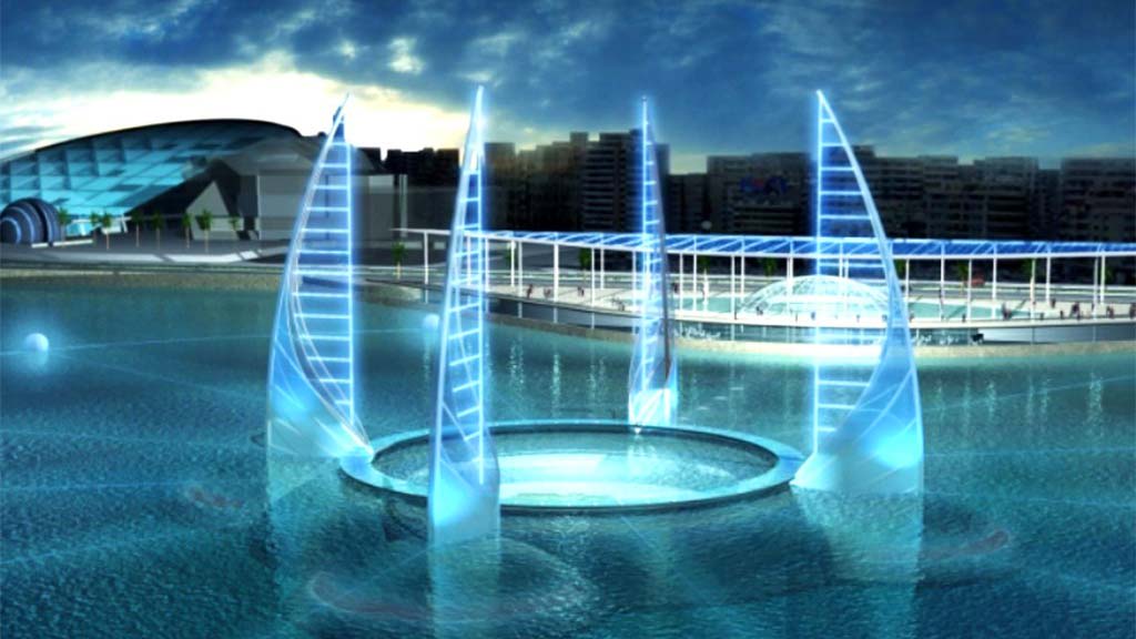
الأشرعة الأربعة (The Four Sails) والقيثارات السماوية: لتأصيل الهوية الثقافية للمشروع، صمم روجيري أربعة هياكل عملاقة تبرز فوق سطح الماء وتعلو الهيكل المغمور. استوحي تصميم هذه الهياكل الشاهقة من أشرعة مركب "الفلوكة" المصري التقليدي المصنوع من الخشب، لتبدو وكأنها أشرعة تمخر عباب الخليج، في حين وُصفت هياكل أخرى بارزة في التصميم بـ "القيثارات السماوية" التي ترتفع من البحيرة لربط النصب التذكارية البرية بالبقايا المغمورة.
مدرسة الآثار البحرية (Underwater Archaeology School): لم يكتفِ التصميم بالجانب الترفيهي، بل تضمن رؤية أكاديمية بدمج منشأة دولية لتعليم الآثار الغارقة ضمن مرافق المتحف. هدف هذا المكون إلى السماح للجمهور العام بمشاهدة ومتابعة أعمال الأثريين والباحثين أثناء قيامهم بعمليات التنقيب والترميم الحية تحت الماء، مما يخلق تفاعلاً مباشراً بين الزائر والعملية العلمية.
الرؤية البصرية والوصف التخيلي للتصميمات
رداً على الرغبة في استحضار صور المشروع، وبما يعكس المخططات التخيلية التي وضعتها شركة (Jacques Rougerie Architecte)، يمكن وصف المشهد البصري للمتحف بأنه أشبه برحلة غوص مستقبلية تلتقي فيها العمارة الخيال-علمية بجلال التاريخ السحيق. في الرسوم التوضيحية للمشروع، يظهر البحر ليلاً مضاءً بتوهج أزرق خافت ينبعث من الأنفاق الزجاجية الغائرة التي تشبه أوردة مضيئة تمتد في قاع المحيط. تبرز أشرعة الفلوكة الزجاجية الأربعة كشواهد بلورية ضخمة تعكس ضوء الشمس نهاراً وتتألق بإضاءة درامية ليلاً.
وصف روجيري نفسه التجربة في مقاطع فيديو تقديمية للمشروع قائلاً: "يُفتح ممشى طويل تحت مساحة مائية هائلة، تغمرها أشعة الشمس والومضات الراقصة لمجموعة مذهلة من التماثيل والآثار في خليج الإسكندرية... هذه العلامات المتحركة من الماضي يتم تعزيزها بسينوغرافيا تجمع بين سحر وجمال عالم ما تحت الماء". كما اقترح التصميم إمكانية استخدام "غواصات زجاجية" صغيرة تسبح في مسارات محددة لتعزيز التجربة، ليتمكن الزائر من ملامسة أسرار قصر كليوباترا السابعة دون أن يبتل.
القدرة الاستيعابية والجدوى الزمنية
صُمم هذا الصرح الجبار ليكون نقطة جذب سياحية عالمية رئيسية، حيث قُدرت قدرته الاستيعابية لاستقبال نحو 3 ملايين زائر سنوياً، وهو رقم يضاهي كبرى المتاحف البرية العالمية. أما فيما يتعلق بالجدول الزمني، فقد قدر المهندس روجيري أن تستغرق أعمال البناء والتشييد الفعلية حوالي عامين، يُضاف إليها الفترات اللازمة لاستكمال المسوحات الطبوغرافية والتخطيط الدقيق للموقع.
الإطار المؤسسي ودراسات الجدوى الدولية
لضمان التوافق مع المعايير العلمية والمواثيق الدولية، تحركت الحكومة المصرية بخطى مؤسسية مدروسة. في عام 2008، أعلنت منظمة اليونسكو رسمياً دعمها لخطط مصر لإنشاء هذا المتحف المبتكر، مؤكدة على أهميته في تعزيز الوعي بالتراث الثقافي المغمور وحمايته من التخريب وناهبي الكنوز، في ظل تحديات تطبيق القانون الدولي بشكل صارم على مياه الإقليمية.
في يناير من عام 2009، انطلقت رسمياً دراسة الجدوى الشاملة للمشروع، والتي مُولت بشكل رئيسي من قبل مؤسسة هيلتي (Hilti Foundation) وعالم الآثار فرانك جوديو، وذلك باستخدام العوائد المالية التي حُققت من جولات معارض الآثار السكندرية المتنقلة حول العالم. في ربيع العام ذاته، عقدت "اللجنة الاستشارية العلمية الدولية" التابعة لليونسكو، والتي ضمت نخبة من كبار العلماء والخبراء من ضمنهم جان إيف إمبرير وفرانك جوديو، جلستها الأولى لمراجعة الجوانب التقنية والأثرية، وصولاً إلى صياغة التقرير النهائي لدراسة الجدوى في يناير 2010.
تمحور الإطار القانوني الحاكم لهذا المشروع حول مبادئ اتفاقية اليونسكو لعام 2001 الخاصة بحماية التراث الثقافي المغمور بالمياه، والتي صادقت عليها مصر. تنص هذه الاتفاقية بوضوح في مادتها الأولى وقواعدها الملحقة على أن خيار "الحفظ في الموقع" (In situ preservation) يجب أن يُعتبر الخيار الأول والمفضل إدارياً قبل اللجوء إلى أي إجراءات تدخلية أو عمليات انتشال، إلا في الحالات التي تستدعيها ضرورة الحماية من التدمير أو لغايات علمية ملحة. وقد وفرت الهيئة الاستشارية العلمية والتقنية (STAB) التابعة للاتفاقية إرشادات صارمة حول كيفية إدارة الموقع بما يضمن عدم إحداث تغيير جذري في بيئة الآثار.
رغم التصاميم الساحرة والزخم المؤسسي الدولي، وجد مشروع متحف الآثار الغارقة نفسه عالقاً في دوامة من التحديات المتشابكة التي أحبطت محاولات نقله من حيز الورق إلى حيز التنفيذ. بحلول عام 2011، توقف المشروع بشكل شبه كامل، ورغم المحاولات الخجولة لإحيائه في عامي 2013 و 2015 من قبل بعض وزراء الآثار المتعاقبين أمثال الدكتور ممدوح الدماطي، إلا أن معوقات أساسية حالت دون خروجه للنور. يمكن تشريح وفهم هذه المعوقات عبر أربعة محاور محورية متداخلة:
أولاً: التحديات البيئية المائية (معضلة الرؤية والتلوث)
شكلت البيئة البحرية، وتحديداً في منطقة الميناء الشرقي، جداراً عازلاً أمام تحقيق الحلم الزجاجي. تعاني المياه الساحلية للإسكندرية، التي كانت صالحة للرؤية بوضوح في حقبة الثلاثينيات، من تدهور بيئي حاد أصبح يهدد بقاء الآثار ذاتها، ناهيك عن إمكانية عرضها.
عكارة المياه وانعدام الرؤية (Water Turbidity): كشفت التقارير الحكومية المتتابعة الصادرة عن وزارة البيئة المصرية أن غالبية المياه الساحلية في المدينة ملوثة، حيث تُعد مناطق الميناء الشرقي وأبي قير والدخيلة من أكثر البقاع تضرراً نتيجة ارتباطها المباشر أو غير المباشر بمصادر صرف صحي غير معالج أو معالج جزئياً. هذا الضخ المستمر للملوثات يتسبب في ارتفاع هائل لنسبة المواد العالقة في المياه، مما يخفض مستوى الرؤية (Visibility) إلى درجات تقارب الصفر في بعض الأيام. وفي ظل هذا الوضع، تصبح فكرة إنشاء أنفاق زجاجية باهظة التكلفة لمشاهدة الآثار أمراً عبثياً، إذ لن يتمكن الزائر من رؤية ما هو أبعد من بضعة سنتيمترات وراء الزجاج.
التخثث المائي والنمو البيولوجي (Eutrophication): وثقت الدراسات الأوقيانوغرافية، ومنها دراسات قسم علوم البحار بجامعة الإسكندرية، مستويات مرتفعة من الأملاح المغذية في مياه الميناء الشرقي، مما يؤدي إلى زيادة هائلة في إنتاجية الهائمات النباتية (Phytoplankton) والنمو الشاذ للطحالب، فضلاً عن حدوث ظاهرة "المد الأحمر" (Red Tide). هذا النشاط البيولوجي المفرط يؤدي حتماً إلى تراكم الكائنات الحية الدقيقة والطحالب على الأسطح الزجاجية الخارجية (Fiberglass) للمتحف المغمور بسرعة فائقة. ونظراً لأن النظام المائي هنا هو نظام مفتوح لا يمكن فلترته بشكل مركزي كما يحدث في الأحواض الصناعية، فإن ضمان الشفافية البصرية سيتطلب عمليات تنظيف ميكانيكي مستمرة وباهظة التكلفة طوال اليوم.
تراكم القمامة والمخلفات البحرية: نظراً لأن الميناء الشرقي يمثل خليجاً شبه مغلق، فقد تحول عبر العقود إلى مصيدة تتجمع فيها أعداد هائلة من قوارب الصيد واليخوت التي تلقي مخلفاتها، بالإضافة إلى تراكم شباك الصيد المهملة، والنفايات البلاستيكية، والمخلفات الصلبة فوق الآثار ذاتها. هذا الواقع المتردي تطلب تدخلات طارئة، كما حدث في يوليو 2023 حين أشرفت وزيرة البيئة الدكتورة ياسمين فؤاد على حملة كبرى لانتشال المخلفات من قاع الميناء الشرقي بمشاركة 40 غطاساً، لإنقاذ ما يمكن إنقاذه من التدهور البيئي.
ثانياً: المعضلات الجيولوجية والهندسية
طرح المخطط المعماري الذي صممه روجيري تحديات هندسية فذة، وربما غير قابلة للحل بتكلفة معقولة، في مجال هندسة المنشآت المغمورة:
قوى الضغط والدفع المائي (Hydrostatic Pressure and Uplift): يتطلب بناء هيكل بقطر 40 متراً وعمق 7 أمتار استخدام مواد متقدمة قادرة على تحمل الضغط الهيدروستاتيكي المستمر وملوحة البحر المتوسط العالية. الأهم من ذلك هو ظاهرة الدفع إلى أعلى (Uplift of Water)؛ فالهياكل المغمورة المفرغة من الماء تعمل كعوامات ضخمة تتعرض لقوة طفو هائلة تحاول دفعها نحو السطح. لتثبيت مثل هذا الهيكل في قاع يتكون غالباً من طبقات طميية رخوة ورمال، يحتاج المهندسون إلى زرع أوتاد وأساسات عميقة جداً (Anchoring)، وهو ما يعيدنا إلى خطر تدمير الآثار القابعة تحت التربة.
النشاط الزلزالي وتميع التربة (Soil Liquefaction): لا يمكن تجاهل التاريخ الجيولوجي للإسكندرية. لقد غرفت هذه المدن (كانوب، هيراكليون، وجزء من الإسكندرية) أساساً بسبب سلسلة من الزلازل القوية والانهيارات التكتونية وتسونامي متكرر عبر القرون الماضية. إن إنشاء بنية تحتية زجاجية وخرسانية دقيقة في منطقة صدوع نشطة يعرض استثمارات بملايين الدولارات وحياة الزوار للخطر البالغ. علاوة على ذلك، كشفت الدراسات أن الإسكندرية القديمة بُنيت على تلال ساحلية جيرية مغطاة بطبقات من الطين وطمي النيل، مما يجعل التربة هشة وعرضة لظاهرة "التميع" (Liquefaction) أثناء الهزات الأرضية، حيث تفقد التربة صلابتها وتتصرف كالسائل.
تحديات التغير المناخي المستقبلي: دقت الأبحاث البيئية الحديثة ناقوس الخطر بشأن التهديد الوجودي الذي يواجه الساحل السكندري. أكدت سارة فؤاد، الخبيرة في هندسة المناظر الطبيعية الساحلية، وعصام حجي، عالم الكواكب بجامعة جنوب كاليفورنيا، أن الإسكندرية هي واحدة من أولى المدن التاريخية الكبرى التي بدأت تنهار جزئياً تحت تأثير التغير المناخي. يتزامن ارتفاع منسوب مياه البحر المتوسط مع ظاهرة الهبوط الأرضي الساحلي (Subsidence)، وتوقعت تقارير صادرة عن الأمم المتحدة أن يصبح ثلث مدينة الإسكندرية غير صالح للسكن بحلول عام 2050. الاستثمار في متحف ساحلي ومغمور في ظل هذه التنبؤات المناخية يمثل مقامرة هندسية واقتصادية قصيرة النظر.
ثالثاً: العقبات الاقتصادية والسياسية (تجميد الموارد)
بلغت التقديرات المالية المبدئية لتنفيذ هذا الحلم المعماري ما بين 140 إلى 150 مليون دولار أمريكي، وهو مبلغ ضخم بالمعايير الإنشائية الثقافية.
الاضطرابات السياسية (ثورة 2011): بينما كانت مخرجات دراسة الجدوى قد انتهت في عام 2010، اندلعت ثورة الخامس والعشرين من يناير 2011، وما تبعها من اضطرابات سياسية وتحولات اقتصادية عنيفة في مصر. أدى هذا المشهد المضطرب إلى تجميد فوري للمشروع، حيث أُعيد توجيه الموارد المالية الشحيحة للدولة نحو أولويات اقتصادية واجتماعية أكثر إلحاحاً، وتوقف الاهتمام بالمشاريع السياحية العملاقة طويلة الأجل.
أزمة التمويل والبحث عن مستثمرين: أثبتت الدراسات أن الميزانية المحلية لوزارة الآثار المصرية لا تستطيع تحمل نفقات بناء وتأمين المتحف. ورغم سعي الحكومة لاحقاً لجذب تمويل خارجي، وتداول أنباء حول اهتمام شركات وكيانات صينية متخصصة في البنية التحتية بالاستثمار في المشروع، إلا أن هذه المبادرات بقيت في حيز النوايا ولم ترقَ إلى اتفاقيات تمويلية ملزمة على أرض الواقع.
رابعاً: الجدل الأخلاقي وتعارض منهجيات علم الآثار
شهدت الأروقة الأكاديمية والدوائر الأثرية الدولية جدلاً حاداً حول فلسفة التدخل وتصميم المتحف، وهو ما أضعف الإجماع العلمي حول المشروع:
تدمير السياق المكاني والأصالة (Authenticity): اعتمد الجاذب البصري لمشروع جاك روجيري على تجميع قطع أثرية بارزة، مثل بقايا قصر كليوباترا والفنار، ووضعها في مسار الرؤية المباشر حول الأنفاق الزجاجية لتقديم "سينوغرافيا" درامية. رفض علماء الآثار البارزون هذا التوجه رفضاً قاطعاً، معتبرين أن نقل القطع من مكانها الفعلي لتشكيل عرض مسرحي اصطناعي يفقد الأثر "أصالته" وسياقه التاريخي، ويحوله إلى مجرد ديكور ترفيهي.
مخاطر البناء الإنشائي على الموقع: أشار الخبراء إلى أن الهيكل المغمور بحد ذاته سيسبب أضراراً بالغاً، حيث أن عمليات صب الخرسانة وتثبيت الأساسات وبناء الأنفاق في بيئة مائية رخوة قد تؤدي إلى تكسير وتدمير بقايا أثرية كامنة لم يتم اكتشافها بعد، ناهيك عن التغيير الجذري في جيومورفولوجية قاع الميناء.
التناقض مع روح اتفاقية 2001: يرى الجناح المحافظ من الأثريين أن بناء منشأة بهذا الحجم التدخلي يتنافى مع الغرض الأساسي لاتفاقية اليونسكو التي دعت إلى "الحفظ الطبيعي" في الموقع. كما انتقد البعض، وعلى رأسهم أثريون مرموقون، المنهجيات التي تتدخل بقوة في تضاريس الموقع الأثري المغمور. <table><tbody><tr><td><strong>محور التحليل</strong></td><td><strong>التفاصيل والعقبات الرئيسية</strong></td><td><strong>التأثير الشامل على المشروع</strong></td></tr><tr><td><strong>البيئة البحرية</strong></td><td>التلوث الصحي، التخثث، عكارة المياه (انعدام الرؤية)، المخلفات الصلبة.</td><td>إسقاط الجدوى الوظيفية للأنفاق الزجاجية تماماً واستحالة الرؤية الواضحة.</td></tr><tr><td><strong>الجيولوجيا والمناخ</strong></td><td>نشاط زلزالي، تميع التربة، الدفع المائي (Uplift)، ارتفاع منسوب البحر بالمتوسط.</td><td>مخاطر كارثية على السلامة الإنشائية وحياة الزائرين، وضعف موثوقية الاستثمار الطويل الأمد.</td></tr><tr><td><strong>التمويل والسياسة</strong></td><td>تكلفة قدرها 140-150 مليون دولار، انقطاع الدعم بسبب أحداث 2011، فشل الاستقطاب الأجنبي.</td><td>تجميد رسمي للمخططات التنفيذية وبقاء التصاميم كدراسات نظرية غير ممولة.</td></tr><tr><td><strong>القيم الأثرية</strong></td><td>التعارض مع مبدأ الأصالة (نقل القطع لتكوين ديكور)، مخاطر الحفر العميق لتثبيت الهياكل.</td><td>سحب الدعم العلمي والمعنوي من قبل فئات واسعة من المجتمع الأثري والمنظمات المعنية.</td></tr></tbody></table>
التحولات الاستراتيجية والبدائل التكنولوجية الحديثة (2024 - 2026)
أمام هذه الحزمة المتشابكة من الاستحالات الفيزيائية والمالية لمشروع "المتحف الزجاجي المغمور"، لم يقف صانع القرار الثقافي المصري والمجتمع العلمي مكتوف الأيدي. فقد أدرك المعنيون ضرورة إحداث "نقلة نموذجية" (Paradigm Shift) والانتقال من فكرة "البناء المكلف في بيئة معادية" إلى استراتيجيات أكثر ذكاءً، ومرونة، وواقعية. خلال الفترة الممتدة بين 2024 والربع الأول من 2026، تبلورت ثلاثة مسارات استراتيجية رئيسية شكلت البديل العملي لمتحف روجيري.
1. مشروع "فاروس" لإعادة البناء الرقمي والتوأمة الافتراضية (PHAROS Project)
بديلاً عن فكرة النزول عبر أنفاق زجاجية لمشاهدة بقايا فنار الإسكندرية في مياه معتمة، تبنت السلطات حلاً جذرياً يعتمد على تكنولوجيا الواقع الافتراضي والتصوير ثلاثي الأبعاد. أُطلق مشروع "PHAROS"، تحت إشراف عالمة الآثار والمعمارية إيزابيل هيري (Isabelle Hairy) من المركز الوطني الفرنسي للبحث العلمي (CNRS)، ومركز الدراسات السكندرية (CEAlex)، وبالشراكة التقنية القوية مع "مؤسسة داسو سيستيمز" (Fondation Dassault Systèmes).
تركزت خطة العمل، التي شهدت ذروتها في يوليو 2025، على انتشال استثنائي لـ 22 كتلة حجرية عملاقة من قاع البحر (بلغ وزن بعضها 80 طناً)، تضمنت عتبات الأبواب، وألواح الأساس، وكتل الجرانيت المكونة للبوابة الضخمة للفنار القديم. الهدف من هذا الاستخراج المؤقت لم يكن النقل إلى متاحف تقليدية، بل إجراء عمليات تصوير مساحي ضوئي دقيق (Photogrammetry) ومسح ليزر عالي الدقة لكل قطعة. يقوم فريق من المهندسين المتطوعين باستخدام هذه البيانات لإنشاء "توأم رقمي" (Digital Twin) للفنار، وإعادة بناء هندسته المعمارية الافتراضية بدقة متناهية تشبه تجميع قطع الأحجية. هذا النهج المتقدم سمح باختبار فرضيات البناء والانهيار للفنار الذي دمرته الزلازل، ويوفر للجمهور العالمي إمكانية "زيارة" النصب التذكاري والتجول بداخله رقمياً، دون أية مخاطر بيئية أو إنشائية.
2. الانتشال الانتقائي الموجه في خليج أبي قير
على مسار متوازٍ، تخلت مصر تدريجياً عن التقيد الحرفي المتشدد بمبدأ "ترك كل شيء تحت الماء" الذي أثبت إعاقته للتنشيط السياحي، وتبنت سياسة "الانتشال الانتقائي" للقطع ذات القيمة الفنية الاستثنائية التي يمكن حفظها وعرضها خارج المياه بأمان، توافقاً مع الاستثناءات التي تسمح بها اتفاقية اليونسكو لحماية الأثر وتقديمه للجمهور.
في حدث تاريخي مشهود في 21 أغسطس 2025، وبحضور وزير السياحة والآثار شريف فتحي، قامت رافعات بحرية عملاقة بنشل مجموعة نادرة من القطع من موقع مدينة كانوب الغارقة في مياه خليج أبي قير. وشملت هذه القطع المذهلة تمثالاً ضخماً من الكوارتز لأبي الهول منقوشاً عليه خراطيش الملك رمسيس الثاني، وتمثالاً من الرخام الأبيض يجسد نبيلاً رومانياً، وبقايا بنى معمارية وتجارية. أكد الوزير شريف فتحي في تصريحاته أن "هناك الكثير تحت الماء، ولكن ما يمكننا إخراجه محدود، ويقتصر على مواد محددة وفقاً لمعايير صارمة (تتعلق بحالة القطعة وعدم تضررها)، في حين سيبقى الباقي جزءاً من تراثنا المغمور". هذا النهج البراغماتي يسمح بتحقيق العوائد السياحية المأمولة مع الحفاظ على سلامة الكتلة الأكبر من الآثار المغمورة وتوفير التمويل المستقبلي.
3. معرض "أسرار المدينة الغارقة" كبديل واقعي وناجح
توجت السياسة الجديدة المتبعة بإنشاء بديل عملي وفعال يتمثل في إقامة معارض كبرى داخل المتاحف البرية. في أعقاب عمليات الانتشال الناجحة، افتتحت الحكومة المصرية في 23 أغسطس 2025 معرضاً أثرياً دولياً مؤقتاً يحمل عنوان "أسرار المدينة الغارقة" (Secrets of the Sunken City)، والذي تستضيفه قاعات متحف الإسكندرية القومي حتى فبراير 2026.
يتيح هذا المعرض الفريد، الذي افتتحه وزير السياحة ومحافظ الإسكندرية، عرض 86 قطعة أثرية نادرة تم إنقاذها من مياه كانوب وهيراكليون، تتنوع بين تماثيل الآلهة القديمة، والعملات الذهبية، وأدوات الحياة اليومية في العصرين البطلمي والروماني. من خلال هذا النهج، نجحت الدولة في جلب سحر العالم الغمور إلى بيئة آمنة، يمكن التحكم في درجة حرارتها ورطوبتها وإضاءتها بشكل مثالي، وتقديمها بأسلوب عرض متحفي مبهر يليق بالجمهور العالمي، لتصبح بديلاً آمناً واقتصادياً متفوقاً بمراحل عن مغامرة بناء الممرات الزجاجية في قاع البحر الملوث.
الأبعاد المستقبلية والتوصيات الاستراتيجية
بناءً على التطورات المتسارعة وتحليل المعطيات العلمية المتاحة حتى منتصف عام 2026، يمكن استخلاص مجموعة من التوصيات والمآلات المستقبلية للتعامل مع هذا الملف بالغ التعقيد:
تجميد الخيارات الإنشائية في الموقع: أصبح من الثابت علمياً واقتصادياً أن مشروع إنشاء متحف مغمور بهياكل زجاجية وخرسانية (كمشروع جاك روجيري) غير قابل للتطبيق في الإسكندرية ضمن المعطيات البيئية والمناخية الحالية. التهديدات المرتبطة بارتفاع مستوى البحر والهبوط الأرضي المستمر تحتم إغلاق النقاش حول الاستثمارات الإنشائية الصلبة على الشريط الساحلي الملامس للمياه المفتوحة.
تعزيز استراتيجية "المتاحف الهجينة": يمثل الجمع بين العرض المتحفي التقليدي للقطع المستخرجة (كما في معرض أسرار المدينة الغارقة) وتقنيات التوأمة الرقمية والواقع الافتراضي (كما في مشروع PHAROS) التوجه الأمثل والأكثر استدامة. ينبغي الاستمرار في الاستثمار بكثافة في تقنيات (VR) و (AR) لخلق جولات افتراضية تتيح للسائح التجول في قصر كليوباترا أو ميناء هيراكليون كما كانت تبدو في أوج مجدها، وهو قطاع يحظى بنمو عالمي مطرد.
إدارة بيئية مستدامة للسواحل: يتوجب توجيه الجهود نحو استكمال عمليات التنظيف البيئي لقاع الميناء الشرقي وخليج أبي قير لمنع التحلل الكيميائي المستمر للآثار بسبب التلوث والمخلفات البلاستيكية، بالإضافة إلى تفعيل القوانين الرادعة لمنع الصيد الجائر وإلقاء شباك الصيد ومخلفات الصرف الصحي في مناطق الآثار، تطبيقاً لالتزامات مصر ضمن خطط برنامج الأمم المتحدة للبيئة.
تأسيس معهد تدريبي لعلوم الآثار البحرية: استلهاماً لأحد الجوانب الإيجابية في تصميم روجيري المقترح، ينبغي تفعيل دور الإسكندرية كمركز إقليمي للتدريب على تقنيات الغوص والتوثيق الأثري تحت الماء، وتعزيز الشراكات بين وزارة السياحة والآثار، وجامعة الإسكندرية، والمعاهد البحثية الأوروبية والصينية لنقل التكنولوجيا وبناء القدرات المحلية في مجال المسح الجيوفيزيائي والانتشال المعقم.
الخاتمة التحليلية
يقدم المسار التاريخي لمشروع "متحف الآثار الغارقة بالإسكندرية" دراسة حالة استثنائية ومعمقة في آليات الإدارة الحديثة للتراث الثقافي وصناعة القرار الاستراتيجي. لقد كشف المشروع، بتصميمه الحالم الساعي لربط عالم اليابسة بقاع البحر عبر أشرعة زجاجية وفلوكة بحرية، عن الهوة العميقة بين الطموح المعماري الثوري والقيود الواقعية الصارمة للبيئة الطبيعية. لقد برهنت العقبات البيئية العاتية—المتمثلة في عكارة المياه، والنشاط البيولوجي الكثيف، والتهديدات الجيولوجية المروعة كالزلازل وتميع التربة—أن الطبيعة تفرض شروطها الخاصة، وأن التصميم الجمالي يفقد معناه إذا استحالت الرؤية، وباتت تكلفة الأمان الإنشائي تستنزف موارد اقتصادية ضخمة لا تملكها موازنات الدول النامية المأزومة سياسياً واقتصادياً.
ومع ذلك، فإن الفشل المؤقت لـ "الهيكل الفيزيائي" للمتحف لم يؤدِّ إلى انهيار الغاية الكبرى المتمثلة في الكشف عن سحر الإسكندرية الغارقة وإتاحته للإنسانية. بل على العكس، شكل هذا التعثر حافزاً لتطوير حلول عبقرية أكثر نضجاً ومسؤولية. إن انتقال السلطات المصرية بالتعاون مع المجتمع الدولي نحو استراتيجيات "التوأمة الرقمية" وابتكار "مشروع فاروس"، وتبني سياسات الانتشال الانتقائي الذكي لآثار نادرة وعرضها في بيئة متحفية آمنة ومبهرة—كما يتجلى بوضوح في نجاح معرض "أسرار المدينة الغارقة" في عامي 2025 و2026—يعكس نضوجاً مؤسسياً رفيعاً. لقد بات واضحاً أن حماية التراث وتقديمه للجمهور لم يعد حكراً على الحلول الخرسانية الغاطسة، بل تبلور في منظومة هجينة تحترم البيئة البحرية، وتخضع للمواثيق الدولية، وتوظف أحدث ما وصلت إليه تكنولوجيا الواقع الافتراضي، لتروي قصة أعظم مدن العصور القديمة بطريقة آمنة، وعالمية، ومستدامة للأجيال القادمة.
Foundational Introduction
Underwater cultural heritage is considered one of the most complex and richest historical records documenting the course of human civilization. In this context, the Egyptian city of Alexandria stands as one of the most important historical metropolises, harboring within its territorial waters an invaluable cultural legacy dating back to the Pharaonic, Ptolemaic, and Roman eras, through to Islamic and modern times. A successive series of violent natural disasters—including devastating earthquakes, fierce tsunamis, continuous land subsidence, and soil liquefaction—has led to the submergence of vast parts of ancient Alexandria and its neighboring coastal cities, settling at the bottom of the Mediterranean Sea for over fourteen centuries. These submerged areas encompassed major centers of political and economic power, most notably the Ptolemaic Royal Quarter, the Palace of Cleopatra VII, and authentic parts of the Lighthouse of Alexandria (the Pharos), which was classified as one of the Seven Wonders of the Ancient World in the Eastern Harbour area. This is in addition to entire commercial and religious cities such as the sunken Heracleion and Canopus in the waters of Abu Qir Bay.
Over the past three decades, an unprecedented global and local ambition has crystallized within archaeological and architectural circles, embodied in the proposal to establish an underwater "Museum of Sunken Antiquities." This extraordinary project aimed to provide visitors from all over the world with the opportunity to visually dive into the depths of history and see these architectural and artistic treasures in their original location (In situ) without the need to recover them and expose them to the risks of environmental degradation outside their aquatic environment. Despite the initial international support the project received, particularly from the United Nations Educational, Scientific and Cultural Organization (UNESCO), and the dazzling futuristic architectural designs created for it to be a global architectural breakthrough, the project's journey collided with a highly complex reality.
This research report addresses, in a detailed analytical and anatomical manner, all dimensions related to the proposed Sunken Antiquities Museum project in Alexandria. The report traces the historical roots of maritime archaeological discoveries that paved the way for the idea's birth and dissects the intricate architectural and engineering details of the proposed design, providing a precise visual description of the blueprints. Furthermore, the report critically and deeply reviews all environmental, geological, technical, economic, and political factors, up to the archaeological ethical dilemmas that combined to cause the project to stumble, be repeatedly postponed, and practically frozen. Finally, the report monitors the strategic shifts and modern technological alternatives that imposed themselves on the scene until 2026, offering hybrid solutions that combine virtual reality with targeted selective recovery.
The Historical Context of Maritime Archaeological Discoveries in Alexandria
The idea of establishing a museum for sunken antiquities did not emerge from a vacuum; rather, it came as the culmination of a long chronological and cognitive accumulation of maritime archaeological discoveries that began to take shape since the early twentieth century. These developed through a series of pivotal milestones led by local and international pioneers. An accurate understanding of the sheer volume and diversity of these discoveries is the true gateway to grasping the justifications and motives that led to proposing this massive project.
Early Beginnings and First Surveys
The initial signs of interest in Alexandria's submerged antiquities date back to the period between 1911 and 1915, when the French engineer Gaston Jondet, who worked as the chief engineer for the Egyptian Ports and Lighthouses Authority, made the first systematic scientific observations to discover sunken structures in Alexandria's Western Harbour area. Despite the importance of these observations, interest waned for years until the early 1930s, when a British pilot, while flying over Abu Qir Bay, noticed accumulations of massive sunken artifacts beneath the waters, which were exceptionally clear during that era. The pilot informed Prince Omar Toussoun, the grandson of Muhammad Ali Pasha and a prominent enthusiast of history and geography. Toussoun initiated the organization and funding of the first preliminary archaeological survey in the area, resulting in significant discoveries that included the remains of the temple of the city of Heracleion, massive quantities of pottery, and rare statues such as a granite head believed to belong to Alexander the Great, in addition to a Sphinx statue.
The Turning Point in the 1960s
The 1960s witnessed a true qualitative leap in the trajectory of Egyptian sunken antiquities, specifically in 1962, thanks to the efforts of Egyptian diver Kamel Abu El-Saadat. A professional diver and heritage lover, Abu El-Saadat managed to create the first two accurate topographical maps of the sunken antiquities sites: the first focused on the Eastern Harbour, and the second covered Abu Qir Bay. These individual efforts caught the attention of official authorities, specifically the Egyptian Naval Forces, which took the initiative to collaborate with him in April and November 1962 to recover a collection of prominent artifacts from the site of the ancient Lighthouse of Alexandria. Continuing this exploratory momentum, Abu El-Saadat's efforts culminated in 1965 with the discovery of the wreckage of three ships from the sunken French fleet, including the famous flagship "L'Orient," which sank during the historic naval Battle of Abu Qir between the French fleet led by Napoleon Bonaparte and the English fleet led by Horatio Nelson.
International Institutional Intervention and Scientific Methodology
Faced with the succession of these astonishing discoveries, the international community realized the necessity of intervening to scientifically organize and document this heritage. In 1968, UNESCO sent the first specialized scientific mission in maritime archaeology, headed by pioneer expert Honor Frost and researcher Vladimir Nesteroff. This mission conducted precise topographical surveys and established the modern scientific methodology for dealing with submerged heritage in Egyptian waters.
As the 1990s began, the coasts of Alexandria witnessed an unprecedented intensification of systematic underwater excavation, led by two main scientific currents. The first current was the French mission belonging to the Centre d'Études Alexandrines (CEAlex), founded in 1989 and led by archaeologist Jean-Yves Empereur. This mission faced monumental challenges in 1993 when hundreds of giant concrete blocks were dropped into the water to protect the Citadel of Qaitbay from coastal erosion, which led to the obliteration of parts of the Lighthouse of Alexandria's archaeological site and threatened the safety of the remaining artifacts. Empereur and his team intervened urgently in 1994 to conduct a series of rescue dives that successfully pinpointed the location of nearly 3,500 massive architectural elements, including column capitals, bases, sphinxes, obelisks, and colossal statues blending Egyptian and Greek artistic styles—pieces that collectively constitute the remains of the ancient Lighthouse.
The second current was represented by the European Institute for Underwater Archaeology (IEASM), led by archaeologist Franck Goddio, which focused its efforts, in collaboration with the Egyptian Supreme Council of Antiquities, on conducting a comprehensive and precise topographical survey of the Eastern Harbour using the latest geophysical monitoring technologies. Goddio's discoveries in 1992 resulted in identifying the detailed layout of the ancient Eastern Harbour with its royal basins, uncovering ten sub-ports, including the Great Port and the Inner Port. The mission also successfully uncovered the island of Antirhodos and the Timonium peninsula, shedding light on the architectural remains of the royal palace historically associated with Queen Cleopatra VII and Mark Antony. The institute's discoveries did not stop at the Eastern Harbour but expanded at the dawn of the third millennium to include the discovery of the cities of Heracleion (Thonis) and Canopus, completely submerged in Abu Qir Bay, revealing stunning ports, tombs, and temples preserved under layers of silt for thousands of years. In a notable development, Goddio's team announced the discovery of the wreckage of a massive ceremonial ship (Pleasure Barge) in the Eastern Harbour dating back to the Ptolemaic era, which is believed to match the historical description recorded by the ancient geographer Strabo of the luxurious boats (Thalamagoi) used in royal ceremonies near the Temple of Isis.
<table><tbody><tr><td><strong>Historical Phase</strong></td><td><strong>Timeframe</strong></td><td><strong>Key Figures/Actors</strong></td><td><strong>Prominent Discoveries and Contributions</strong></td></tr><tr><td><strong>Early Explorations</strong></td><td>1911 - 1930</td><td>Gaston Jondet, Prince Omar Toussoun</td><td>Observations in the Western Harbour, discovery of the Heracleion temple and the head of Alexander the Great.</td></tr><tr><td><strong>Topographical Mapping and Foundation</strong></td><td>1962 - 1965</td><td>Kamel Abu El-Saadat, Egyptian Naval Forces</td><td>Mapping the Eastern Harbour and Abu Qir, discovery of Napoleon's fleet (L'Orient).</td></tr><tr><td><strong>International Institutional Framing</strong></td><td>1968</td><td>UNESCO (Honor Frost, Vladimir Nesteroff)</td><td>Establishing the foundations of scientific topographical surveying for submerged antiquities.</td></tr><tr><td><strong>Modern Systematic Excavation</strong></td><td>1992 - Present</td><td>Jean-Yves Empereur (CEAlex), Franck Goddio (IEASM)</td><td>Identifying 3,500 pieces of the Lighthouse, discovery of Cleopatra's palace, Antirhodos Island, the cities of Canopus and Heracleion, and the royal ceremonial barge.</td></tr></tbody></table>
This dense cognitive accumulation, along with the massive amount of artifacts that are difficult to fully recover or preserve outside their natural environment, is what prompted the Egyptian government, represented by the Ministry of Antiquities (at the time) and in coordination with international organizations, to adopt a pioneering idea in 1996: building the world's first sunken antiquities museum to allow the public access to these monuments in their original location.
Architectural and Engineering Vision: Detailing Jacques Rougerie's Project
The architectural aspects of the Sunken Antiquities Museum project presented a massive innovative challenge. What was required was not just a traditional building, but a hybrid structure connecting the land to the seabed of the Eastern Harbour, providing a safe environment that allows visitors inexperienced in diving to explore the submerged ruins in their original setting. Discussions continued for years, culminating in UNESCO organizing an international workshop in 2006 that brought together stakeholders to formulate the project's goals and define its cultural and economic framework.
In 2008, after winning an international competition organized by the Egyptian government and UNESCO, the world-renowned French architect Jacques Rougerie undertook the project's design as the lead architect for the feasibility study team. Rougerie possesses a prestigious international reputation in the field of "Biomorphic Architecture," inspired by the forms of marine organisms. He has extensive experience in designing underwater laboratories and villages, drawing inspiration from the works of novelist Jules Verne, astronaut Yuri Gagarin, and explorer Jacques Cousteau. Rougerie responded to the challenge with a magical design that reflects Egypt's deep connection to its maritime history, aiming to revolutionize the concept of global museum exhibition.
The Architectural Structure of the Proposed Museum
The architectural plan proposed by Rougerie relied on an integrated composition connecting the waterfront to the seabed of the Eastern Harbour (or Abu Qir Bay, according to later proposals to modify the location). The design included the following structural elements:
The Inland Building and the Agora Plaza: This structure is located on the shores of Alexandria's bay, near the symbolic site of the new Bibliotheca Alexandrina. The inland building houses traditional exhibition halls for artifacts previously recovered for preservation necessities, as well as a heritage interpretation center and service facilities. Extending in front of the building is a vast "Agora" plaza offering a panoramic view of the bay's waters and the Corniche, serving as the main gathering point for visitors before they begin their aquatic journey.
The Submerged Fiberglass Tunnels: Visitors embark from the inland building, descending through a complex network of tunnels made of high-quality, highly transparent reinforced fiberglass. These tunnels extend to a depth of 5 to 7 meters (about 20 to 23 feet) below sea level. These corridors were designed to withstand hydrostatic pressure and provide clear visibility, allowing visitors to literally walk on the seabed, explore the sunken cities, and wander among more than 2,500 rare artifacts resting in the depths.
The Underwater Hall: The tunnel network connects to a massive, circular, submerged hall or plaza with a diameter of 40 meters. The total area of the underwater complex is about 22,000 square meters. This hall represents the beating heart of the museum, surrounded by a breathtaking aquatic scenography showcasing the giant granite blocks of the Lighthouse of Alexandria's ruins, some weighing tens of tons, alongside artifacts associated with the Ptolemaic royal palace and the royal galley anchorage.
The Four Sails and Celestial Harps: To root the project's cultural identity, Rougerie designed four massive structures that protrude above the water's surface, towering over the submerged hull. The design of these towering structures was inspired by the sails of the traditional wooden Egyptian "Felucca" boat, appearing as if they are sails navigating the bay's waves. Other prominent structures in the design were described as "Celestial Harps" rising from the lagoon to connect the terrestrial monuments with the submerged remains.
Underwater Archaeology School: The design did not settle for the entertainment aspect alone; it included an academic vision by integrating an international facility for teaching underwater archaeology within the museum's amenities. This component aimed to allow the general public to watch and follow the work of archaeologists and researchers as they conduct live underwater excavation and restoration operations, creating direct interaction between the visitor and the scientific process. Visual Vision and Imaginative Description of the Designs In response to the desire to conjure up the project's imagery, and reflecting the conceptual blueprints created by Jacques Rougerie Architecte, the visual scene of the museum can be described as a futuristic diving journey where sci-fi architecture meets the majesty of ancient history. In the project's illustrations, the sea appears at night illuminated by a faint blue glow emitting from the sunken glass tunnels, resembling luminous veins extending across the ocean floor. The four glass felucca sails stand out as massive crystalline beacons reflecting sunlight during the day and glowing with dramatic lighting at night. Rougerie himself described the experience in presentation videos for the project, stating: "A long walkway opens beneath a vast expanse of water, bathed in sunlight and the dancing flashes of an astonishing collection of statues and antiquities in the Bay of Alexandria... These moving markers from the past are enhanced by a scenography that combines the magic and beauty of the underwater world." The design also suggested the possibility of using small "glass submarines" navigating specific paths to enhance the experience, enabling the visitor to touch the secrets of Cleopatra VII's palace without getting wet. Capacity and Timetable Feasibility This colossal edifice was designed to be a major global tourist attraction, with an estimated capacity to host about 3 million visitors annually—a figure comparable to major international land-based museums. As for the timeline, architect Rougerie estimated that the actual construction and building works would take about two years, in addition to the periods needed to complete topographical surveys and detailed site planning. Institutional Framework and International Feasibility Studies To ensure compliance with scientific standards and international conventions, the Egyptian government took calculated institutional steps. In 2008, UNESCO officially announced its support for Egypt's plans to build this innovative museum, emphasizing its importance in raising awareness of underwater cultural heritage and protecting it from vandalism and treasure looters, especially given the challenges of strictly enforcing international law in territorial waters. In January 2009, the comprehensive feasibility study for the project officially launched, funded primarily by the Hilti Foundation and archaeologist Franck Goddio, utilizing financial returns generated from touring exhibitions of Alexandrian antiquities worldwide. In the spring of that same year, the "International Scientific Advisory Committee" affiliated with UNESCO, which included elite senior scientists and experts such as Jean-Yves Empereur and Franck Goddio, held its first session to review the technical and archaeological aspects, culminating in the drafting of the final feasibility study report in January 2010. The governing legal framework for this project centered around the principles of the 2001 UNESCO Convention on the Protection of the Underwater Cultural Heritage, which Egypt ratified. This convention clearly stipulates in its first article and annexed rules that the option of "In situ preservation" must be considered the first and administratively preferred choice before resorting to any intrusive interventions or recovery operations, except in cases necessitated by the need for protection against destruction or for urgent scientific purposes. The Scientific and Technical Advisory Body (STAB) of the convention provided strict guidelines on how to manage the site to ensure no radical changes are made to the antiquities' environment.
Systematic Analysis of Postponement and Stumbling Factors (Deconstructing the Crisis)
Despite the enchanting designs and international institutional momentum, the Sunken Antiquities Museum project found itself caught in a vortex of intertwined challenges that thwarted attempts to move it from paper to execution. By 2011, the project had come to a near-complete halt. Despite timid attempts to revive it in 2013 and 2015 by some successive Ministers of Antiquities, such as Dr. Mamdouh El-Damaty, fundamental obstacles prevented it from seeing the light. These obstacles can be dissected and understood through four overlapping core axes:
First: Aquatic Environmental Challenges (The Dilemma of Visibility and Pollution)
The marine environment, specifically in the Eastern Harbour area, formed an impenetrable wall against realizing the glass dream. Alexandria's coastal waters, which offered clear visibility in the 1930s, suffer from severe environmental degradation that now threatens the survival of the antiquities themselves, let alone the possibility of displaying them.
Water Turbidity and Zero Visibility: Successive government reports issued by the Egyptian Ministry of Environment revealed that the majority of coastal waters in the city are polluted. The areas of the Eastern Harbour, Abu Qir, and El-Dekheila are among the most affected spots due to their direct or indirect connection to untreated or partially treated sewage sources. This continuous pumping of pollutants causes a massive increase in the percentage of suspended matter in the water, reducing visibility to near-zero levels on some days. Under this situation, the idea of building exorbitantly expensive glass tunnels to view the antiquities becomes absurd, as the visitor will not be able to see more than a few centimeters beyond the glass.
Water Eutrophication and Biological Growth: Oceanographic studies, including those by the Oceanography Department at Alexandria University, documented high levels of nutrient salts in the Eastern Harbour's waters. This leads to a massive increase in phytoplankton productivity, abnormal algal growth, as well as the occurrence of the "Red Tide" phenomenon. This excessive biological activity inevitably leads to the rapid accumulation of microorganisms and algae on the external fiberglass surfaces of the submerged museum. Given that the aquatic system here is an open one that cannot be centrally filtered as in artificial aquariums, ensuring visual transparency would require continuous, prohibitively expensive mechanical cleaning operations throughout the day.
Accumulation of Garbage and Marine Debris: Because the Eastern Harbour is a semi-closed bay, it has turned over the decades into a trap accumulating huge numbers of fishing boats and yachts that dump their waste, in addition to the buildup of discarded fishing nets, plastic waste, and solid debris right on top of the antiquities. This deteriorating reality required emergency interventions, as happened in July 2023 when Minister of Environment Dr. Yasmine Fouad supervised a major campaign to extract waste from the seabed of the Eastern Harbour with the participation of 40 divers, to salvage what could be saved from environmental degradation. Second: Geological and Engineering Dilemmas The architectural plan designed by Rougerie posed formidable, and perhaps affordably unsolvable, engineering challenges in the field of submerged structural engineering:
Hydrostatic Pressure and Uplift Forces: Building a structure with a 40-meter diameter and a 7-meter depth requires the use of advanced materials capable of withstanding constant hydrostatic pressure and the high salinity of the Mediterranean Sea. More importantly is the phenomenon of water uplift; submerged structures emptied of water act as massive buoys subjected to immense buoyancy forces trying to push them toward the surface. To anchor such a structure to a seabed consisting mostly of soft silt layers and sand, engineers need to plant very deep foundations and piles (Anchoring), which brings us back to the risk of destroying the antiquities buried beneath the soil.
Seismic Activity and Soil Liquefaction: Alexandria's geological history cannot be ignored. These cities (Canopus, Heracleion, and part of Alexandria) originally sank due to a series of strong earthquakes, tectonic collapses, and recurrent tsunamis over the past centuries. Establishing delicate glass and concrete infrastructure in an active fault zone puts multimillion-dollar investments and visitors' lives at extreme risk. Furthermore, studies revealed that ancient Alexandria was built on coastal limestone ridges covered by layers of clay and Nile silt, making the soil fragile and prone to "Liquefaction" during earthquakes, where the soil loses its stiffness and behaves like a liquid.
Future Climate Change Challenges: Recent environmental research has sounded the alarm regarding the existential threat facing the Alexandrian coast. Sarah Fouad, an expert in coastal landscape architecture, and Essam Heggy, a planetary scientist at the University of Southern California, confirmed that Alexandria is one of the first major historical cities beginning to partially collapse under the impact of climate change. The rise in Mediterranean Sea levels coincides with the phenomenon of coastal subsidence, and UN-issued reports have predicted that one-third of the city of Alexandria could become uninhabitable by 2050. Investing in a coastal and submerged museum amid these climate forecasts represents a short-sighted engineering and economic gamble. Third: Economic and Political Obstacles (Freezing of Resources) Initial financial estimates for realizing this architectural dream amounted to between 140 to 150 million US dollars, a massive sum by cultural construction standards.
Political Turmoil (2011 Revolution): While the feasibility study outputs were completed in 2010, the January 25th Revolution erupted in 2011, followed by political turmoil and violent economic shifts in Egypt. This turbulent scene led to an immediate freeze of the project, as the state's scarce financial resources were redirected toward more pressing economic and social priorities, and interest in massive, long-term tourism projects came to a halt.
Funding Crisis and the Search for Investors: Studies proved that the local budget of the Egyptian Ministry of Antiquities could not bear the expenses of building and securing the museum. Despite the government's later efforts to attract foreign funding, and the circulation of news about the interest of specialized Chinese infrastructure companies and entities in investing in the project, these initiatives remained in the realm of intentions and did not amount to binding financing agreements on the ground. Fourth: Ethical Controversy and Conflicting Archaeological Methodologies Academic corridors and international archaeological circles witnessed intense debate over the philosophy of intervention and the museum's design, which weakened the scientific consensus around the project:
Destruction of Spatial Context and Authenticity: The visual appeal of Jacques Rougerie's project relied on assembling prominent artifacts, such as the remains of Cleopatra's palace and the Lighthouse, and placing them in the direct line of sight around the glass tunnels to create a dramatic "scenography." Prominent archaeologists categorically rejected this approach, arguing that moving pieces from their actual location to form an artificial theatrical display strips the monument of its "authenticity" and historical context, turning it into mere entertainment decor.
Construction Risks to the Site: Experts pointed out that the submerged structure itself would cause severe damage. Operations such as pouring concrete, anchoring foundations, and building tunnels in a soft aquatic environment could lead to the fracturing and destruction of latent archaeological remains that have not yet been discovered, let alone radically altering the geomorphology of the harbor seabed.
Contradiction with the Spirit of the 2001 Convention: The conservative wing of archaeologists believes that building an intrusive facility of this magnitude contradicts the fundamental purpose of the UNESCO convention, which advocated for "natural preservation" in situ. Some, led by esteemed archaeologists, also criticized methodologies that heavily interfere with the topography of the submerged archaeological site. <table><tbody><tr><td><strong>Axis of Analysis</strong></td><td><strong>Main Details and Obstacles</strong></td><td><strong>Overall Impact on the Project</strong></td></tr><tr><td><strong>Marine Environment</strong></td><td>Health pollution, eutrophication, water turbidity (zero visibility), solid waste.</td><td>Complete collapse of the functional feasibility of the glass tunnels and the impossibility of clear vision.</td></tr><tr><td><strong>Geology and Climate</strong></td><td>Seismic activity, soil liquefaction, water uplift, rising Mediterranean sea levels.</td><td>Catastrophic risks to structural safety and visitor lives, and weak reliability for long-term investment.</td></tr><tr><td><strong>Funding and Politics</strong></td><td>Cost of $140-150 million, cutoff of support due to 2011 events, failure to attract foreign investment.</td><td>Official freeze of executive plans, leaving designs as unfunded theoretical studies.</td></tr><tr><td><strong>Archaeological Values</strong></td><td>Conflict with the principle of authenticity (moving pieces to create decor), risks of deep excavation to anchor structures.</td><td>Withdrawal of scientific and moral support by broad segments of the archaeological community and relevant organizations.</td></tr></tbody></table>
Strategic Shifts and Modern Technological Alternatives (2024 - 2026)
Faced with this tangled bundle of physical and financial impossibilities for the "Submerged Glass Museum" project, Egyptian cultural decision-makers and the scientific community did not stand idly by. Stakeholders realized the necessity of creating a "Paradigm Shift" and moving from the idea of "expensive construction in a hostile environment" to smarter, more flexible, and more realistic strategies. During the period between 2024 and the first quarter of 2026, three main strategic paths crystallized to form a practical alternative to Rougerie's museum.
1. The "PHAROS" Project for Digital Reconstruction and Virtual Twinning
As an alternative to the idea of descending through glass tunnels to view the remains of the Lighthouse of Alexandria in murky waters, authorities adopted a radical solution relying on virtual reality technology and 3D imaging. The "PHAROS" project was launched under the supervision of archaeologist and architect Isabelle Hairy from the French National Centre for Scientific Research (CNRS) and the Centre d'Études Alexandrines (CEAlex), in strong technical partnership with the Dassault Systèmes Foundation.
The action plan, which peaked in July 2025, focused on the exceptional recovery of 22 massive stone blocks from the seabed (some weighing up to 80 tons), including door lintels, foundation slabs, and granite blocks forming the massive gateway to the ancient lighthouse. The goal of this temporary extraction was not transportation to traditional museums, but rather conducting precise photogrammetry and high-resolution laser scanning for each piece. A team of volunteer engineers used this data to create a "Digital Twin" of the lighthouse and virtually reconstruct its architecture with extreme precision, akin to assembling puzzle pieces. This advanced approach allowed for testing the construction and collapse hypotheses of the earthquake-destroyed lighthouse, offering the global public the ability to "visit" the monument and wander inside it digitally, without any environmental or structural risks.
2. Targeted Selective Recovery in Abu Qir Bay
On a parallel track, Egypt gradually abandoned strict literal adherence to the principle of "leaving everything underwater," which had proven to hinder tourism activation. It adopted a policy of "selective recovery" for pieces of exceptional artistic value that can be safely preserved and displayed outside the water, in accordance with the exceptions permitted by the UNESCO convention to protect the artifact and present it to the public.
In a landmark historical event on August 21, 2025, attended by Minister of Tourism and Antiquities Sherif Fathy, giant marine cranes recovered a rare collection of artifacts from the site of the sunken city of Canopus in the waters of Abu Qir Bay. These stunning pieces included a massive quartz sphinx inscribed with the cartouches of King Ramses II, a white marble statue depicting a Roman nobleman, and remains of architectural and commercial structures. Minister Sherif Fathy affirmed in his statements that "There is much underwater, but what we can extract is limited, and restricted to specific materials according to strict criteria (related to the piece's condition and ensuring it is unharmed), while the rest will remain part of our submerged heritage." This pragmatic approach allows for achieving the hoped-for tourism revenues while preserving the integrity of the largest mass of sunken antiquities and securing future funding.
3. "Secrets of the Sunken City" Exhibition as a Realistic and Successful Alternative
The new policy adopted culminated in creating a practical and effective alternative represented in establishing major exhibitions within land-based museums. Following the successful recovery operations, the Egyptian government inaugurated on August 23, 2025, a major temporary international archaeological exhibition titled "Secrets of the Sunken City," hosted in the halls of the Alexandria National Museum until February 2026.
This unique exhibition, inaugurated by the Minister of Tourism and the Governor of Alexandria, allows for the display of 86 rare artifacts salvaged from the waters of Canopus and Heracleion. These range from statues of ancient deities and gold coins to items of daily life in the Ptolemaic and Roman eras. Through this approach, the state succeeded in bringing the magic of the submerged world into a safe environment, where temperature, humidity, and lighting can be perfectly controlled. It is presented in a dazzling museum display style befitting a global audience, becoming a safe and economically superior alternative to the adventure of building glass corridors in the polluted seabed.
Future Dimensions and Strategic Recommendations
Based on the rapid developments and analysis of scientific data available up to mid-2026, a set of future recommendations and outcomes can be drawn for handling this highly complex file:
Freezing In-Situ Construction Options: It has become scientifically and economically established that the project of building a submerged museum with glass and concrete structures (like Jacques Rougerie's project) is unfeasible in Alexandria under the current environmental and climatic conditions. Threats related to rising sea levels and continuous land subsidence necessitate closing the debate on hard structural investments on the coastal strip touching open waters.
Enhancing the "Hybrid Museums" Strategy: Combining traditional museum displays of recovered pieces (as in the Secrets of the Sunken City exhibition) with digital twinning and virtual reality technologies (as in the PHAROS project) represents the optimal and most sustainable approach. Continuous heavy investment should be directed into VR and AR technologies to create virtual tours allowing tourists to wander through Cleopatra's palace or the port of Heracleion as they looked in their prime—a sector experiencing steady global growth.
Sustainable Coastal Environmental Management: Efforts must be directed towards completing the environmental cleanup operations of the Eastern Harbour and Abu Qir Bay seabeds to prevent the ongoing chemical degradation of antiquities due to pollution and plastic waste. Additionally, stringent laws must be activated to prevent overfishing and the dumping of fishing nets and sewage waste in archaeological areas, in compliance with Egypt's commitments under the United Nations Environment Programme plans.
Establishing a Training Institute for Underwater Archaeology: Drawing inspiration from a positive aspect in Rougerie's proposed design, Alexandria's role should be activated as a regional center for training in diving techniques and underwater archaeological documentation. Partnerships should be strengthened between the Ministry of Tourism and Antiquities, Alexandria University, and European and Chinese research institutes to transfer technology and build local capacities in the fields of geophysical surveying and sterile recovery.
Analytical Conclusion
The historical trajectory of the "Alexandria Sunken Antiquities Museum" project offers an exceptional and in-depth case study in modern cultural heritage management mechanisms and strategic decision-making. The project, with its dreamy design seeking to connect the terrestrial world to the seabed via glass sails and a marine felucca, exposed the deep chasm between revolutionary architectural ambition and the strict realistic constraints of the natural environment. The formidable environmental obstacles—represented by water turbidity, dense biological activity, and terrifying geological threats such as earthquakes and soil liquefaction—have proven that nature dictates its own terms. Aesthetic design loses its meaning if visibility is impossible, and the cost of structural safety drains massive economic resources that the budgets of politically and economically challenged developing nations do not possess.
However, the temporary failure of the museum's "physical structure" did not lead to the collapse of the ultimate goal: uncovering the magic of sunken Alexandria and making it accessible to humanity. On the contrary, this stumbling block acted as a catalyst for developing brilliant, more mature, and responsible solutions. The Egyptian authorities' shift, in cooperation with the international community, towards "digital twinning" strategies, the invention of the "PHAROS Project," and the adoption of smart selective recovery policies for rare artifacts to be displayed in a safe and dazzling museum environment—as clearly manifested in the success of the "Secrets of the Sunken City" exhibition in 2025 and 2026—reflects high institutional maturity. It has become clear that protecting heritage and presenting it to the public is no longer the exclusive domain of submerged concrete solutions; rather, it has crystallized into a hybrid system that respects the marine environment, complies with international conventions, and employs state-of-the-art virtual reality technology to tell the story of the greatest city of antiquity in a safe, global, and sustainable manner for future generations.