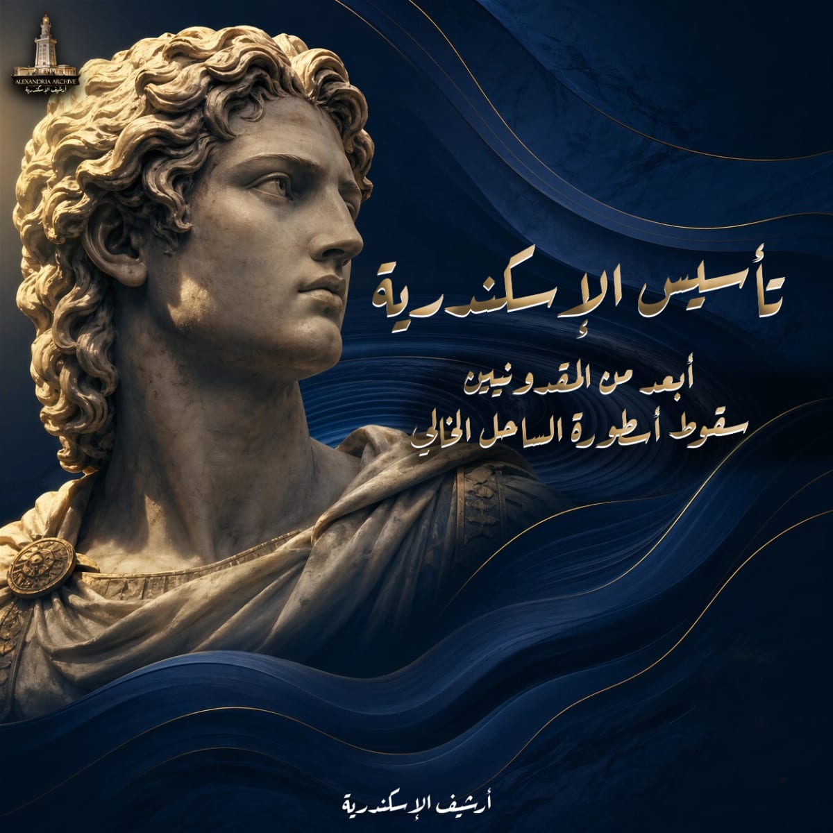
The Comprehensive Report on the Actual Founding Date of the City of Alexandria
Eslam Ali —
دراسة في الجذور الأثرية، والكرونولوجيا التاريخية، والتوجيه الفلكي
تشكل دراسة الأصول التاريخية والعمرانية لمدينة الإسكندرية في مصر واحدة من أكثر الإشكاليات الأكاديمية تعقيداً وثراءً في حقل الدراسات الكلاسيكية والتاريخ القديم. وعلى الرغم من أن الذاكرة الشعبية والاحتفالات المدنية المعاصرة غالباً ما تربط المدينة بتواريخ حديثة لا تمت بصلة للحقبة القديمة (مثل العيد القومي للمدينة المحتفل به في السادس والعشرين من يوليو، والذي يرتبط بأحداث سياسية حديثة كخروج الملك فاروق وتأميم قناة السويس)، إلا أن التحقيق الأكاديمي الدقيق يسعى إلى استعادة اللحظة الزمنية الدقيقة والآليات المعقدة التي أسست لواحدة من أعظم حواضر العالم الهلنستي. يهدف هذا التقرير البحثي المستفيض إلى تفكيك السرديات التاريخية، ومقارعة المصادر الكلاسيكية القديمة بالأدلة الأثرية الحديثة المكتشفة تحت الماء، واستخلاص التاريخ الفعلي لتأسيس المدينة على يد الإسكندر الأكبر، والذي يتمحور حول السابع من أبريل لعام 331 قبل الميلاد. كما يعرج التقرير على تحليل التوجيه الفلكي لتخطيط المدينة، والرموز الأيديولوجية التي صاحبت طقوس التأسيس.
الجذور الأثرية والطبوغرافية: دحض أسطورة الساحل الخالي
استندت السردية التقليدية التي روجت لها بعض المصادر اليونانية والرومانية لفترة طويلة إلى افتراض أن الإسكندر الأكبر قد شيد مدينته العظمى على أرض ساحلية مقفرة شبه خالية، باستثناء وجود قرية صغيرة ومتواضعة لصيادي الأسماك تُدعى "راقودة" (Rhacotis). إلا أن التحليلات العلمية الحديثة، والبيانات المستمدة من علم الآثار الغارقة، والتحليلات الجيولوجية واللغوية، تقوض هذه السردية الاختزالية، وتكشف عن تعقيد استيطاني وتجاري أقدم بكثير من الحقبة المقدونية.
تُظهر الدراسات الإيتيمولوجية (علم أصول الكلمات) أن النصوص المصرية القديمة أشارت إلى هذا الموقع باسم "راقودة" (Ra-qedet). يرى فريق من الباحثين، مثل ميشيل شوفو (Michel Chaveau) من المدرسة التطبيقية للدراسات العليا، أن الجذر المصري (qd) يعني "يصنع" أو "يبني"، وأن السابقة (r-ꜥ) تعمل كأداة اشتقاقية لتشكيل أسماء الفعل، مما يرجح أن الاسم قد يعني ببساطة "موقع البناء" (Building site) أو "البناء قيد الإنجاز"، وهو مصطلح ربما أطلقه المصريون على ورشة التشييد الضخمة التي بدأها الإسكندر لتأسيس مدينته. في المقابل، يجادل علماء مصريات آخرون، مثل جون باينز (John Baines)، بأن التركيب اللغوي للاسم والسياق الدلالي يشيران بوضوح إلى أن التسمية أقدم من التواجد اليوناني بكثير، مما يؤكد وجود مستوطنة قائمة بذاتها ذات أهمية استراتيجية.
تكتسب وجهة النظر القائلة بوجود استيطان قديم وكثيف دعماً قاطعاً من نتائج المسوحات الأثرية البحرية الشاملة التي أجريت في الميناء الشرقي للإسكندرية (Portus Magnus). بدأت هذه الجهود بشكل مبكر مع المهندس الفرنسي غاستون جونديه (Gaston Jondet) في عام 1916 الذي اكتشف منشآت مرفئية قديمة غرب جزيرة فاروس، وتلته أبحاث كمال أبو السعادات في الستينيات. لكن النقلة النوعية تحققت منذ عام 1992 عندما بدأ المعهد الأوروبي للآثار الغارقة (IEASM) تحت إشراف عالم الآثار الميداني فرانك غوديو (Franck Goddio)، وبالتعاون مع المجلس الأعلى للآثار المصري، برنامجاً مكثفاً لمسح قاع الميناء.
شملت منطقة البحث حوالي 400 هكتار، وتم استخدام تقنيات إلكترونية متقدمة مثل أجهزة الرنين المغناطيسي النووي (NMR) وأجهزة قياس المغناطيسية لتحديد مواقع البقايا الأثرية المدفونة تحت طبقات كثيفة من الرواسب التي تراكمت عبر آلاف السنين بفعل الزلازل وموجات المد البحري (التسونامي) والسيولة الأرضية التي أغرقت أجزاء كبيرة من ساحل الإسكندرية القديم.
أسفرت هذه الحفريات المنهجية عن اكتشافات تسبق العصر الهلنستي بمراحل زمنية سحيقة، وتتضمن:
تمثال لأبي الهول برأس صقر مصنوع من حجر الغرانوديوريت الأسود، يُرجح أنه يعود إلى القرن السابع أو الثامن قبل الميلاد.
أعمدة ضخمة من الغرانيت الوردي ذات تيجان برديّة، ثبت أنها كانت تنتمي في الأصل إلى مجمع مبانٍ في مدينة ممفيس القديمة، وتحمل نقوشاً وخراطيش بأسماء فراعنة من عصر الدولة الحديثة، مثل تحتمس الرابع، سيتي الثاني، ومرنبتاح.
اثني عشر تمثالاً إضافياً لأبي الهول، يُعتقد أن البطالمة قد جلبوا بعضها من هليوبوليس، ولكنها تشير إلى دمج التراث الفرعوني في بنية الموقع. علاوة على ذلك، قدمت تحليلات النظائر المشعة واختبارات الكربون المشع (Radiocarbon dating) التي أجريت على شظايا الأصداف الدقيقة، بالإضافة إلى دراسات نسب التلوث بعنصر الرصاص في الرواسب (والتي تعتبر مؤشراً دقيقاً على الأنشطة المعدنية والصناعية البشرية)، أدلة لا تقبل الدحض على وجود نشاط بشري مكثف في هذا الموقع الساحلي يمتد إلى عصر الدولة القديمة الفرعونية (بين القرنين السابع والعشرين والحادي والعشرين قبل الميلاد)، ومرحلة نشاط مستقلة أخرى بين عامي 1000 و 800 ق.م. وتشير هذه الاكتشافات المادية بوضوح إلى أن اختيار الإسكندر الأكبر لهذا الموقع لم يكن مجرد صدفة جغرافية إلهامية أو اختياراً لأرض بكر، بل كان استثماراً جيوستراتيجياً في بنية تحتية ومرفئية قديمة. هذا الموقع الساحلي كان جزءاً من شبكات تجارية واسعة النطاق شملت استيراد المعادن من مناطق بعيدة مثل قبرص وجنوب تركيا الحديثة. وقد تمت إعادة هيكلة هذا الموقع ودمجه ضمن المشروع الإمبراطوري الهلنستي الوليد، بحيث أصبحت مستوطنة "راقودة" القديمة بمثابة الحي المصري الرئيسي في الجانب الغربي من المدينة الجديدة المتسعة.
الإطار الكرونولوجي لحملة الإسكندر: التناقض بين 332 و 331 ق.م
يعتبر تحديد العام الدقيق لتأسيس المدينة نقطة نقاش محورية ومستمرة في الأوساط الأكاديمية والتاريخية، حيث تتأرجح السرديات بين أواخر عام 332 ق.م وربيع عام 331 ق.م. لفهم هذا التباين الدقيق، يجب تحليل الجدول الزمني لحملة الإسكندر العسكرية في مصر خطوة بخطوة، مع إخضاع المصادر الكلاسيكية للنقد التاريخي المقارن.
وصل الإسكندر الأكبر إلى مشارف مصر في خريف عام 332 ق.م، وذلك بعد انتصاره العسكري الساحق على العاهل الفارسي داريوس الثالث في معركة إسوس (Issus)، وعقب نجاحه في كسر شوكة المقاومة الفينيقية عبر حصاره الطويل والدموي لمدينة صور (Tyre)، تلاه إسقاط مدينة غزة. كان المصريون يرزحون تحت وطأة الاحتلال الفارسي القاسي منذ عام 343 ق.م، ولذلك استقبلوا الإسكندر بصفته محرراً يحمل لواء الخلاص من النير الفارسي. وعند وصوله إلى مدينة بيلوزيوم (الفرما حالياً) التي تمثل البوابة الشرقية لمصر، لم يواجه أي مقاومة عسكرية تُذكر من قبل المرزبان (الحاكم الفارسي) مازاسيس (Mazaces)، الذي سلم مقاليد السلطة سلمياً.
في شهر نوفمبر من عام 332 ق.م، واصل الإسكندر تقدمه جنوباً نحو العاصمة التقليدية القديمة منف (ممفيس)، حيث أقام احتفالات دينية كبرى وتُوج بشكل تقليدي كفرعون لمصر، مقدماً القرابين للآلهة المصرية وعلى رأسها عجل آبيس، في خطوة سياسية تهدف إلى استمالة الكهنوت المصري وكسب شرعية الحكم المطلق. بعد استقرار الأوضاع في العاصمة، انطلق الإسكندر في مطلع الشتاء في رحلة استكشافية عبر فرع النيل الكانوبي متجهًا نحو الشمال الغربي، ليصل إلى المنطقة الساحلية المحصورة بين البحر الأبيض المتوسط شمالاً وبحيرة مريوط (Lake Mareotis) جنوباً.
تطرح المصادر الكلاسيكية القديمة إشكاليات كرونولوجية حادة حول التوقيت الدقيق الذي اختار فيه الإسكندر تخطيط المدينة وإجراء طقوس التأسيس، وذلك مقارنةً برحلته الروحانية الشهيرة إلى معبد الوحي (أوراكل) للإله آمون في واحة سيوة بالصحراء الغربية. يمكن تقسيم هذا التباين التأريخي إلى مدرستين أو تقليدين رئيسيين:
<table><tbody><tr><td><strong>التقليد التأريخي الكلاسيكي</strong></td><td><strong>المؤرخون الممثلون</strong></td><td><strong>التسلسل الزمني لحدث التأسيس</strong></td><td><strong>التحليل والسياق الأكاديمي</strong></td></tr><tr><td><strong>تقليد ما قبل سيوة (Pre-Siwa Tradition)</strong></td><td>آريانوس (Arrian)، بلوتارخ (Plutarch)</td><td>قام الإسكندر بتحديد الموقع وتخطيط المدينة ورسم حدودها <strong>قبل</strong> انطلاقه في رحلته الشاقة إلى واحة سيوة.</td><td>يعتمد المؤرخ آريانوس (في عمله المرجعي "صعود الإسكندر" أو "الأنباسيس") على مذكرات قادة مقدونيين رافقوا الإسكندر، وتحديداً بطليموس الأول وأريستوبولوس. يذكر آريانوس أن الإسكندر حدد موقع المدينة وأعطى توجيهاته الهندسية للمهندس دينوكراتس، ثم غادر فوراً إلى سيوة. يعتبر هذا التقليد الأكثر موثوقية من الناحية العسكرية والجغرافية.</td></tr><tr><td><strong>تقليد ما بعد سيوة (Post-Siwa Tradition)</strong></td><td>ديودوروس الصقلي (Diodorus Siculus)، كوينتوس كورتيوس روفوس (Curtius Rufus)، جاستين (Justin)، بالإضافة إلى نصوص "رواية الإسكندر"</td><td>تم التأسيس الرسمي للمدينة <strong>بعد</strong> عودة الإسكندر من سيوة، وفي طريقه لمغادرة مصر والعودة إلى فينيقيا (سوريا).</td><td>يمثل هذا الاتجاه تقليد ما يُعرف بـ "الفولغاتا" (Vulgate Tradition) المستمد أساساً من كتابات المؤرخ كليتارخوس (Cleitarchus). تشير هذه المصادر إلى أن الإسكندر سعى أولاً للحصول على الشرعية الإلهية والنبوءة من أوراكل آمون، وبناءً على التوجيهات الإلهية للوحي، عاد ليؤسس المدينة لتكون تجسيداً لإرادة الآلهة.</td></tr></tbody></table>
التحليل التوفيقي والموقف الأكاديمي المعاصر: يتجه التوافق الأكاديمي الحديث، والذي تبلور عبر جهود مؤرخين بارزين مثل أ. ب. بوسورث (A.B. Bosworth)، وإيان ورثينغتون (Ian Worthington)، وعالم البرديات بيتر باغنال (R. S. Bagnall)، إلى التوفيق الدقيق بين هذين التقليدين المتعارضين ظاهرياً. يكمن الحل المنطقي والتاريخي في التمييز الحاسم بين "اختيار الموقع المبدئي والتخطيط الهندسي" من جهة، وبين "التأسيس الرسمي والاحتفال الطقوسي" من جهة أخرى. من المرجح بشدة أن الإسكندر، أثناء وصوله إلى الساحل في أواخر عام 332 ق.م أو يناير 331 ق.م، تفقد الموقع وأدرك إمكانياته الجيومورفولوجية الفريدة، فأصدر الأوامر الأولية للمهندس دينوكراتس بوضع التصميمات الشبكية. بعد ذلك، انطلق مع حاشيته في رحلته الطويلة والمحفوفة بالمخاطر إلى واحة سيوة. وتؤكد الدلائل المناخية، مثل تعرض القافلة لأمطار غزيرة وعواصف رملية (رياح الخماسين المبكرة)، أن الرحلة تمت في منتصف الشتاء. وعند عودته من سيوة مكللاً بالشرعية الإلهية المطلقة كـ "ابن للإله آمون-زيوس"، أقام حفل التأسيس الرسمي والطقوسي للمدينة في أوائل الربيع، وتحديداً في السابع من أبريل عام 331 ق.م، وذلك قبل مغادرته الأراضي المصرية نهائياً في نفس الشهر عائداً إلى فينيقيا لتعقب الملك الفارسي. وبناءً على هذا التسلسل، يُعد عام 331 ق.م هو العام الأكاديمي الدقيق للتأسيس الرسمي للإسكندرية ككيان حضري واحتفالي مستقل.
تفكيك تاريخ 7 أبريل 331 ق.م: الأصل النصي وآليات تحويل التقويم
يعتبر تاريخ 7 أبريل 331 ق.م (7 April 331 BC) التاريخ الأكثر قبولاً وتداولاً في الأوساط الأكاديمية للتأسيس الرسمي للإسكندرية. لكن السؤال المنهجي الذي يطرح نفسه بقوة: من أين أتى هذا التاريخ الدقيق باليوم والشهر، وكيف تم حسابه علمياً في ظل غياب التوثيق الإداري المباشر؟
المفارقة التاريخية هي أن اليوم والشهر الدقيقين لتأسيس الإسكندرية لا ينبعان من سجلات المؤرخين العسكريين الرصينين مثل آريانوس أو بلوتارخ، بل ينبعان من نص أدبي شعبي ذي طابع شبه أسطوري عُرف عبر العصور باسم "رواية الإسكندر" (Alexander Romance) أو (Pseudo-Callisthenes). هذا العمل السردي، الذي تطور في الإسكندرية خلال العصر الهلنستي (ويرى بعض النقاد مثل ريتشارد ستونمان أن نواته الأولى كُتبت في القرن الثالث قبل الميلاد)، يمزج بين الحقائق التاريخية والخيال الأسطوري، مقدماً شخصية نكتانيبو الثاني (آخر فراعنة مصر) كأب سري للإسكندر يستخدم التنجيم لتحديد مساره. وعلى الرغم من الطابع الأسطوري العام للرواية، إلا أنها احتفظت بتفصيلة تقويمية يُجمع العلماء على أصالتها وموثوقيتها الإدارية: لقد تم تأسيس الإسكندرية في اليوم الخامس والعشرين من شهر "طوبة" المصري (25 Tybi).
ولتقييم الموثوقية التاريخية لهذا التاريخ المنفرد واستخراج ما يوازيه في تقويمنا الحديث، خاض علماء البرديات وعلم الكرونولوجيا الفلكية (مثل ريتشارد باركر وفالدو دوبرشتاين) مسيرة معقدة لتحويل هذا التاريخ المصري القديم إلى التقويم اليولياني.
إشكالية تحويل التقويم المصري إلى التقويم اليولياني الاستباقي
كان التقويم المدني المصري القديم تقويماً شمسياً بسيطاً يتكون من 365 يوماً (موزعة على 12 شهراً، كل منها 30 يوماً، بالإضافة إلى 5 أيام النسيء المعقبة)، بدون تطبيق نظام السنة الكبيسة. هذا النقص في الكبس أدى إلى ما يُعرف بـ "السنة المتحركة" (Vague year)، حيث كان التقويم المصري ينزاح أو يتقهقر بمقدار ربع يوم كل عام (أو يوم كامل كل أربع سنوات) مقارنة بالسنة الشمسية الفلكية الحقيقية التي تبلغ 365.2422 يوماً.
لتحويل تاريخ 25 طوبة في عام 331 ق.م إلى ما يوازيه في التقويم الغربي، يجب استخدام "التقويم اليولياني الاستباقي" (Proleptic Julian Calendar)، وهو التقويم المستمر المُستخدم في علم الفلك وبرمجيات تحويل التواريخ التاريخية، والذي يحسب الأيام المتصلة منذ منتصف نهار الأول من يناير عام 4713 قبل الميلاد.
يخضع تحويل تاريخ 25 طوبة لسيناريوهين رئيسيين يعتمدان بشكل أساسي على الزمن والمناخ السياسي الذي كُتبت فيه النسخة الأصلية من "رواية الإسكندر":
<table><tbody><tr><td><strong>السيناريو التقويمي</strong></td><td><strong>فرضية الاستخدام</strong></td><td><strong>النتيجة المكافئة في التقويم اليولياني</strong></td><td><strong>التقييم الأكاديمي</strong></td></tr><tr><td><strong>حساب التقويم البطلمي (المصري المتحرك القديم)</strong></td><td>يفترض هذا السيناريو أن المؤلف (أو ناقل التقليد الشفهي) قد استخدم التقويم المصري القديم غير المعدل الذي كان سارياً فعلياً في فترة ما قبل العصر الروماني (وهو الأقرب زمنياً لفترة تأسيس المدينة في القرن الرابع ق.م).</td><td>يتوافق 25 طوبة في عام 331 ق.م تماماً مع يوم <strong>7 أبريل</strong>.</td><td>يُعتبر هذا السيناريو الأكثر دقة تاريخياً ومنطقياً، حيث يتطابق مع تحركات الإسكندر ومع المعطيات المناخية للربيع.</td></tr><tr><td><strong>حساب التقويم الروماني (السكندري الأغسطسي)</strong></td><td>يفترض هذا السيناريو أن كاتب المخطوطات المتأخرة للرواية قد استند إلى التقويم "السكندري" الثابت الذي أدخله الإمبراطور أغسطس قيصر عام 25 ق.م، والذي دمج نظام السنة الكبيسة الرومانية مع الأشهر المصرية لإنهاء انزياح التقويم.</td><td>بحسب التقويم السكندري الثابت، يتوافق يوم 25 طوبة بشكل دائم مع <strong>20 يناير</strong>.</td><td>يُستبعد هذا السيناريو بالنسبة لحدث وقع في عام 331 ق.م. ومع ذلك، فإن تبني بعض المؤرخين والمصادر العربية الحديثة لتاريخ (21 يناير) لتأسيس المدينة نابع من هذا الخلط التقويمي.</td></tr></tbody></table>
ترجيح وحسم تاريخ 7 أبريل: يستند الإجماع الأكاديمي المعاصر، بدعم من مؤرخين وعلماء كلاسيكيات بارزين مثل بيير جوغيه (Pierre Jouguet) وروجر باغنال، إلى القطع بصحة تاريخ 7 أبريل (وفق التقويم المتحرك) لعدة أسباب تاريخية ومناخية مترابطة :
السياق المناخي وتوقيت الحملات: تذكر المصادر، ومنها كتابات أريستوبولوس، أن الإسكندر غادر مصر متجهاً شرقاً إلى فينيقيا مع "أولى بوادر الربيع الحقيقي". هذا التوقيت المناخي يتوافق تماماً مع أواخر شهر مارس أو أوائل أبريل. وبالتالي، فإن إقامة احتفال تأسيسي كبير للمدينة في 7 أبريل ينسجم بسلاسة تامة مع كونه الفعل السيادي الأخير والأكثر أهمية للإسكندر قبيل وداعه النهائي لمصر.
المنطق الزمني لرحلة سيوة: تستغرق الرحلة اللوجستية بالخيول والجمال من الساحل الشمالي إلى واحة سيوة عبر الصحراء القاحلة والعودة منها، بالإضافة إلى فترة الإقامة الطقوسية بممفيس، وقتاً يتجاوز الشهرين. إذا كان الإسكندر قد انطلق لاستشارة أوراكل آمون في منتصف الشتاء مستفيداً من المطر العرضي الذي ذكرته المصادر لتأمين المياه لجيشه ، فإن عودته للساحل وإقامة مراسم التأسيس ستكون حتماً في فصل الربيع (أبريل)، وهو ما يدحض زمنياً ومكانياً فرضية التأسيس في 20 يناير.
مهرجان "أغاثوس دايمون": الدليل الديني والتراثي المحلي المستقل
من الأدلة القاطعة والمستقلة التي تعزز وتؤكد موثوقية تاريخ 25 طوبة (7 أبريل) في الذاكرة الجمعية والتراث السكندري القديم هو السجل الديني للمهرجانات. تؤكد العديد من البرديات والنصوص الدينية المتأخرة أن يوم 25 طوبة لم يكن مجرد تاريخ إداري مجرد، بل كان يمثل العيد السنوي المهيب للإله "أغاثوس دايمون" (Agathos Daimon)، وهو الكيان الإلهي الذي اتخذ هيئة ثعبان وعُبد بوصفه الروح الحامية و"جنيوس لوكي" (Genius Loci) لمدينة الإسكندرية.
ارتبطت أسطورة أغاثوس دايمون ارتباطاً تكوينياً وثيقاً بقصة تأسيس الإسكندرية ذاتها. تشير الأساطير المحلية والوثائق التأسيسية التي سجلت لاحقاً إلى أنه أثناء أعمال الحفر والتشييد الأولى للمدينة، أثار العمال ثعباناً هائلاً (أو تنيناً) كان يسكن الموقع، فتم قتله. وبدلاً من تجاهل الحدث، وتماشياً مع الحساسية الدينية الهلنستية التي تتطير من مثل هذه الأحداث، أمر الإسكندر ببناء مزار بطولي (Heroon) في ذات الموقع لتبجيل روح الثعبان كحامٍ للمدينة.
أصبحت عبادة أغاثوس دايمون تجسيداً عبقرياً للتلفيق الديني (Syncretism)؛ حيث دمجت بين التقاليد اليونانية لعبادة الأبطال المؤسسين، والتقاليد المصرية العريقة التي تقدس الآلهة الثعبانية الحامية (مثل الإله شاي Shai، وكنيف Kneph). إن إقامة أهم مهرجان ديني وشعبي للمدينة في يوم 25 طوبة، حيث كانت تقدم القرابين وتُغذى الثعابين المقدسة، يؤكد بشكل غير مباشر استمرار ذكرى يوم التأسيس الفعلي عبر القرون وتجذره في الوعي المجتمعي، مما يحول 25 طوبة (7 أبريل) من مجرد إشارة عابرة في رواية أدبية إلى ممارسة شعائرية حية وثقت لحظة ميلاد المدينة.
لم يكن تشييد الإسكندرية على يد المقدونيين مجرد إجراء هندسي أو نفعي بحت لإنشاء قاعدة بحرية متقدمة لتأمين السيطرة على شرق البحر المتوسط، بل كان عملاً أيديولوجياً محكماً يهدف إلى تجسيد القوة الإلهية للمؤسس وتطبيق نظريات الفلسفة العمرانية اليونانية، في استجابة مباشرة للنقاشات الفلسفية التي أثارها فلاسفة مثل أفلاطون، ومعلم الإسكندر أرسطو، حول مفهوم "المدينة المثالية" التي تعكس تناغماً كونياً.
رؤية هوميروس وتحديد الموقع الجغرافي
ينقل المؤرخ بلوتارخ (في القرن الأول الميلادي) في كتابه المرجعي "حياة الإسكندر"، اعتماداً على مصادر هيلنستية مفقودة، قصة الرؤيا الأسطورية التي حددت موقع المدينة. يذكر بلوتارخ أن الإسكندر كان على وشك الموافقة على موقع بديل اختاره مهندسوه، إلا أنه بينما كان نائماً في خيمته، اختبر رؤية واضحة لرجل مهيب ذي شعر أبيض (يُعتقد فوراً أنه الشاعر الأكبر هوميروس) وقف بجانبه وتلا عليه أبياتاً من ملحمة "الأوديسة" تصف جزيرة تقع أمام سواحل مصر تُدعى "فاروس".
استيقظ الإسكندر فوراً، وتوجه في الحال إلى جزيرة فاروس التي كانت تقع عند فم الفرع الكانوبي للنيل. وهناك، لاحظ القائد الشاب المزايا الجغرافية الاستثنائية للمكان: شريط أرضي يابسي يشبه البرزخ العريض يفصل بين بحيرة عظيمة وخصبة (مريوط) وبين مياه البحر الأبيض المتوسط، مما يوفر مرسى مزدوجاً آمناً. حينها، أعلن الإسكندر أن هوميروس ليس فقط أعظم الشعراء قاطبة، بل هو أيضاً "أحكم المهندسين المعماريين"، وأمر بتغيير الخطط لتطابق هذا الموقع المختار إلهياً وشعرياً.
التخطيط الشبكي وتصميم عباءة "الخلاميس"
أُسندت مهمة التخطيط الحضري وتوزيع المساحات إلى كبير المهندسين المعماريين دينوكراتس الرودسي (Dinocrates of Rhodes)، الذي كان يُعد من ألمع العقول المعمارية في عصره. اتبع دينوكراتس النمط الحضري المعياري المعروف بـ "النمط الهيبودامي" (Hippodamian grid)، وهو التخطيط الذي يعتمد على شبكة متعامدة بصرامة من الشوارع الطولية والعرضية المتقاطعة بزوايا قائمة، مما يسهل حركة الجيوش وتنظيم التيارات الهوائية.
لم يكن الإطار الخارجي للمدينة مجرد مربع هندسي مصمت. فقد تم تصميم الشكل العام لأسوار المدينة بحيث يحاكي شكل الـ "خلاميس" (Chlamys)، وهو العباءة العسكرية المقدونية التقليدية القصيرة التي كانت تُربط عند الكتف. هذا التشكيل العمراني لم يكن مجرد استجابة لطوبوغرافية الأرض الممتدة بين البحر والبحيرة، بل كان تجسيداً أيديولوجياً مادياً للهيمنة العسكرية المقدونية الملقاة كعباءة ضخمة على الساحل المصري، كرسالة واضحة لكل قادم عبر البحر أن هذا هو مقر القوة الإمبراطورية الجديدة.
طقوس التأسيس: دقيق الشعير والنبوءة المبكرة
شهدت طقوس تحديد الحدود الأرضية للمدينة حادثة أصبحت محورية في السرديات الكلاسيكية للتأسيس. أثناء تخطيط أسوار المدينة، تطلب الأمر استخدام مسحوق الطباشير الأبيض أو الجير لرسم الخطوط الهندسية العريضة على التربة الداكنة. ولعدم توافر الطباشير في المعسكر في تلك اللحظة، أمر الإسكندر العمال باستخدام دقيق الشعير (أو البولينتا Polenta) المخصص لغذاء الجنود، كبديل لرسم الخطوط الدائرية والمستقيمة التي كونت شكل العباءة.
وفور رسم الخطوط البيضاء بالدقيق واستكمال الشكل الهندسي، حدث أمر مفاجئ؛ حيث هبطت أسراب هائلة ومنوعة من الطيور القادمة من مستنقعات البحيرة وضفاف النهر، كالغيوم السوداء التي غطت الموقع، والتهمت كل حبات الدقيق المرسومة على الأرض، لتمحو بذلك التخطيط المادي لأسوار المدينة في دقائق معدودة.
أصاب هذا الحدث غير المتوقع الإسكندر بقلق وتوتر شديدين، معتبراً إياه نذير شؤم كبيراً يعكس غضب الآلهة على مشروعه. إلا أن العرافين والكهنة المرافقين له، وعلى رأسهم العراف الموثوق أريستاندر (Aristander)، سارعوا إلى طمأنته محولين هذا المشهد إلى نبوءة إيجابية ومبشرة للغاية. فقد فسر أريستاندر المشهد بأن المدينة التي يؤسسها لن تكون مجرد قلعة عسكرية، بل ستتمتع بموارد هائلة ووفرة اقتصادية لا مثيل لها، وستصبح بمثابة "أم مُرضعة" (Nursing mother) توفر القوت والأمان للبشر واللاجئين والمهاجرين من جميع الأمم والأعراق، تماماً كما وفرت حدودها الغذاء لطيور السماء التي لا تُحصى.
تعكس هذه الحادثة، التي اهتم بتسجيلها وتواترها كل من بلوتارخ، وآريانوس، وكورتيوس روفوس، الآليات السردية والبروباجاندا السياسية التي استخدمت في العصور الهلنستية لإضفاء صبغة كونية واحتوائية (Cosmopolitan) على الدور المستقبلي للإسكندرية، كمدينة صُممت منذ يومها الأول لتكون مركزاً حضارياً، ومكتبة عالمية، وعاصمة للتجارة والمعرفة، تجمع بين الإغريق، والمصريين، واليهود، وغيرهم في نسيج مجتمعي واحد.
المحور الفلكي للشبكة العمرانية: علم الفلك الأثري والتوجيه الشمسي
لم تتوقف العبقرية الهندسية الكامنة في تخطيط الإسكندرية عند رسم الحدود الخارجية، بل يكشف التحليل المكاني الدقيق للشبكة المتعامدة التي أسسها دينوكراتس أن مسارات الشوارع لم يتم تحديدها عشوائياً، ولم تكن مبنية بالكامل على مجرد التوازي النفعي البسيط مع خط الساحل كما ظن الكثيرون طويلاً. بدلاً من ذلك، تثبت الدراسات الحديثة المتقدمة في حقل "علم الفلك الأثري" (Archaeoastronomy) أن التخطيط الحضري للإسكندرية القديمة كان بمثابة مرصد حضري هائل الحجم يعكس العلاقة الدقيقة بين القوة الملكية الأرضية والنظام الكوني السماوي.
التوجيه الفلكي المزدوج لـ "الشارع الكانوبي"
في دراسة رائدة ومفصلة نُشرت في "مجلة أكسفورد لعلم الآثار" (Oxford Journal of Archaeology) عام 2012، أجرى الباحثان الإيطاليان لويزا فيرو (Luisa Ferro) وجوليو ماغلي (Giulio Magli) تحليلاً فلكياً وطبوغرافياً شاملاً للتخطيط العمراني الأصلي للإسكندرية. تركز التحليل على المحور الطولي الرئيسي والأساسي للمدينة، وهو الشارع التاريخي الواسع المعروف باسم "طريق كانوب" (Canopic Road) والذي شكل العمود الفقري للتخطيط الشبكي، ممتداً من الشرق إلى الغرب، ومقسماً المدينة إلى نصفين، ومركزاً لأهم المباني والمعابد الإدارية.
باستخدام برمجيات فلكية متقدمة قادرة على محاكاة سماء الإسكندرية بدقة متناهية كما كانت تبدو في القرن الرابع قبل الميلاد (مثل برنامج StarryNight Pro 6.0، والذي يأخذ في الاعتبار حركة الترنح البطيئة لمحور الأرض والميل الدقيق عبر آلاف السنين)، أظهرت النتائج بشكل قاطع أن المحور الطولي للمدينة قد تم توجيهه هندسياً بشكل متعمد ودقيق للغاية نحو نقطة جغرافية فلكية محددة: نقطة شروق الشمس في الأفق صبيحة يوم ميلاد الإسكندر الأكبر.
تزامن تاريخ الميلاد: 20 يوليو وشروق الشمس
لإثبات هذا التوافق الرياضي والفلكي، تتبع الباحثون السجلات الكلاسيكية بدقة. وفقاً لما وثقه المؤرخ بلوتارخ، وُلد الإسكندر في اليوم السادس من شهر "هيكاتومبايون" (Hecatombaion) بحسب التقويم الأثيني القديم، وهو الشهر الذي أطلق عليه المقدونيون اسم "لوس" (Lous) في تقويمهم الخاص. وبإجراء التحويلات الفلكية لهذا التاريخ القمري-الشمسي إلى التقويم الشمسي اليولياني الاستباقي، نجد أنه يوافق بدقة تاريخ 20 أو 21 يوليو من عام 356 ق.م.
وبشكل مدهش ينم عن براعة رياضية وفلكية، تتطابق زاوية شروق الشمس (السمت Azimuth) في سماء مدينة الإسكندرية في فجر يوم 20 يوليو بشكل دقيق مع الانحراف الزاوي الذي شُيد عليه الشارع الكانوبي. هذا يعني أنه في يوم ميلاد الإسكندر من كل عام، كانت الشمس تشرق لتصطف تماماً مع الأفق الطولي للشارع العظيم، غامرة إياه بنور مستقيم ومباشر من بوابته الشرقية وحتى نهايته الغربية.
الشروق النجمي لـ "نجم الملك" (Regulus)
لم تتوقف العبقرية الفلكية لتخطيط المدينة عند حدود الشمس فحسب. يوضح التحليل المتقدم لكل من ماغلي وفيرو أنه في نفس فترة التأسيس، وتحديداً في الأيام القريبة جداً من 20 يوليو، كان يحدث ما يُعرف فلكياً بـ "الشروق الاحتراقي" (Heliacal rising) لأحد أسطع نجوم السماء وأهمها في التراث القديم، وهو نجم قلب الأسد أو نجم ريجولوس (Regulus / Alpha Leonis). وكان هذا النجم يشرق من تحت الأفق على نفس الزاوية السمتية الدقيقة للمحور الكانوبي (حوالي 65 درجة و 20 دقيقة، عند ارتفاع درجة واحدة تسمح برؤية نجم من القدر الأول في وهج الفجر).
يكتسب هذا التطابق بُعداً أيديولوجياً هائلاً؛ حيث يُعد نجم ريجولوس، منذ العصور البابلية المبكرة، الرمز الفلكي المطلق للقوة الملكية، والسيادة المطلقة، والمجد العسكري غير المهزوم. إن ظهور "نجم الملك" متزامناً ومصاحباً لشروق الشمس على طول المحور الرئيسي للمدينة، وفي ذات الفجر الذي يوافق ذكرى ميلاد المؤسس، لم يكن مصادفة جغرافية أو هندسية قط. بل كان تطبيقاً نموذجياً وأصيلاً لنمط "مدن الملوك" (King's towns) في العصر الهلنستي، وهو التوجه العمراني والفلسفي الذي يهدف إلى جعل المدينة ذاتها، بأحجارها ومساراتها، أداة تبرير وشرعية تصرح بوضوح ودون كلمات بالقوة الإلهية لمؤسسها وتخلد ألوهيته.
كان التخطيط العمراني يُستغل بذكاء مفرط لخلق تجربة مشهدية وبصرية مبهرة ومقدسة (Epiphany) يوم الاحتفال السنوي بعيد ميلاد الإسكندر (والذي كان يُعتبر بمثابة العيد الأهم في التقويم المدني والديني للمدينة، احتفالاً به كإله حي). ففي هذا اليوم، تتماهى هندسة الأرض مع هندسة السماء، لتبزغ شمس الصباح ويشع نجم الملك بالتوازي التام مع الشارع الرئيسي، لتغمر تماثيل ومعابد المدينة الإمبراطورية بالضوء السماوي، مما يرسخ في وعي السكان مكانة الإسكندر كإله متوج بنور الكون وصاحب شرعية كونية.
يقر الباحثون في حقل علم الفلك الأثري بأن هذه الاستنتاجات الفلكية تتسم بطبيعة استنتاجية، نظراً لغياب النصوص أو المخطوطات الهندسية المكتوبة بقلم المهندس دينوكراتس التي تصف وتؤكد هذا التوجيه بشكل صريح. ومع ذلك، وفي ضوء المنهجية الإحصائية، فإن احتمالات كون هذا التوافق المزدوج والنادر (شروق الشمس الدقيق متزامناً مع الشروق الاحتراقي للنجم الملكي ريجولوس على نفس خط السمت، وفي يوم ميلاد الملك تحديداً) مجرد صدفة عشوائية، هي احتمالات ضئيلة للغاية تكاد تقترب من الصفر. وتتفق هذه النتائج تماماً مع السياق الأيديولوجي الذي كان يسعى الإسكندر وحلفاؤه البطالمة من خلاله لترسيخ ألوهيته وتخليد إرثه كمركز حضاري جديد للعالم. وقد تم رصد ظواهر فلكية-عمرانية مطابقة في مدن ومعالم هيلنستية أخرى بُنيت لاحقاً لتكريم الإسكندر، مثل مدينة سلوقية على نهر دجلة (Seleucia on the Tigris)، ونصب أنطيوخوس في جبل نمرود، مما يؤكد أن التوجيه الفلكي كان سياسة دولة متكاملة.
الخاتمة الاستنتاجية والتحليل النهائي
بناءً على التتبع الاستقصائي الشامل للنصوص الكلاسيكية، والأدلة الأثرية الحديثة المستخرجة من أعماق البحر، والمطابقات التقويمية والفلكية المعقدة، يمكن بلورة الخلاصات الجوهرية التالية حول التاريخ الفعلي لتأسيس مدينة الإسكندرية والآليات المحيطة بهذا الحدث الكوني:
أولاً، من الناحية الأثرية والطبوغرافية، يجب التخلي نهائياً عن أسطورة الفراغ الاستيطاني التي رافقت السرديات اليونانية. لم يكن موقع الإسكندرية أرضاً عذراء خالية، بل كانت قرية راقودة (Ra-qedet) القديمة، بمرساها ومرافقها، مركزاً حضرياً وتجارياً له عمق تاريخي يمتد إلى عصر الدولة القديمة، ومزوداً بمعالم فرعونية بارزة من عصر الدولة الحديثة. إن عبقرية الإسكندر لم تكمن في اختيار بقعة فارغة، بل في قراءته الثاقبة للبنية التحتية القائمة وإعادة هيكلتها ودمجها بمهارة فائقة ضمن مشروعه الإمبراطوري المتمدد، لتتحول قرية الصيادين القديمة إلى الحي المصري الأساسي الذي جاور الأحياء اليونانية واليهودية.
ثانياً، فيما يخص التاريخ الفعلي الدقيق، تثبت التحليلات الكرونولوجية أن الإسكندر وصل إلى مصر واستكشف الساحل في أواخر عام 332 ق.م، لكن التأسيس الطقوسي والرسمي للمدينة تم في ربيع العام التالي، عقب عودته المظفرة بالشرعية الإلهية من معبد آمون في واحة سيوة. تتطابق الوثيقة التراثية السكندرية المتجذرة في "رواية الإسكندر"، والتي حددت التأسيس في "25 طوبة"، توافقاً فلكياً ورياضياً دقيقاً مع يوم 7 أبريل في التقويم اليولياني الاستباقي. ويدعم هذا التاريخ بشدة الملاءمة المناخية لفصل الربيع الذي غادر فيه الإسكندر مصر، وتوافقه مع الجدول الزمني لتحركاته العسكرية، والأهم من ذلك تخليده كعيد ديني مركزي لـ "أغاثوس دايمون" الروح الحامية للمدينة. وبناءً على ذلك، يُعتبر 7 أبريل 331 ق.م هو أدق وأصح تاريخ تاريخي وعلمي لذكرى التأسيس الفعلي للمدينة.
أخيراً، يمثل التخطيط الهندسي والفلكي للمدينة ذروة الكوزمولوجيا العمرانية في العصور القديمة. لم تكن شبكة الشوارع المتعامدة التي رسمت بأبعاد خلاميس عسكري مجرد استجابة جغرافية لساحل البحر المتوسط، بل صُمم المحور الكانوبي الرئيسي ليكون مرصداً أفقياً دقيقاً، تشرق منه شمس الصباح بالتزامن مع نجم "ريجولوس" الملكي في ذكرى ميلاد الإسكندر في العشرين من يوليو. هذه الهندسة الفلكية حولت حجارة المدينة وشوارعها إلى أداة سياسية ناطقة، ولائحة أيديولوجية أبدية تؤكد شرعية الإسكندر المقدوني كحاكم إلهي مطلق.
إن الإسكندرية القديمة، بتاريخ تأسيسها الدقيق الذي يجمع بين شرعية 7 أبريل، وهندستها الفلكية المتألقة في 20 يوليو، وتجذرها في طبقات راقودة الفرعونية، لم تكن مجرد عاصمة إدارية أو ميناء تجاري. بل كانت التجلي الأسمى للفكر البشري القادر على صهر الأساطير الدينية، والجيوسياسية التوسعية، والهندسة المدنية الرائدة، والعلوم الفلكية المتقدمة، لتشكل أعظم مدينة كونية (Cosmopolis) عرفها العالم القديم، وموئلاً حقيقياً للحضارة والفلسفة والتجارة لعابري القارات، محققة بذلك نبوءة الطيور الأولى التي رأت فيها الملاذ للأمم كافة.
A Study in Archaeological Roots, Historical Chronology, and Astronomical Orientation
Studying the historical and urban origins of the city of Alexandria in Egypt is one of the most complex and rich academic inquiries in the field of classical studies and ancient history. Although popular memory and contemporary civic celebrations often link the city to modern dates that have no connection to the ancient era (such as the city’s National Day celebrated on July 26, which is tied to modern political events like the departure of King Farouk and the nationalization of the Suez Canal), rigorous academic investigation seeks to recover the exact moment and the complex mechanisms that established one of the greatest metropolises of the Hellenistic world.
This extensive research report aims to deconstruct historical narratives, compare ancient classical sources with modern underwater archaeological evidence, and deduce the actual founding date of the city by Alexander the Great, which centers around April 7, 331 BC. The report also explores the astronomical orientation of the city's layout and the ideological symbolism that accompanied the founding rituals.
Archaeological and Topographical Roots: Debunking the Empty Coast Myth
The traditional narrative promoted by some Greek and Roman sources has long relied on the assumption that Alexander the Great built his great city on a barren, nearly empty coastal stretch, save for a small, humble fishing village called "Rhacotis." However, modern scientific analyses, data derived from underwater archaeology, and geological and linguistic studies undermine this reductionist narrative, revealing a complex settlement and trade hub much older than the Macedonian era.
Etymological studies indicate that ancient Egyptian texts referred to this site as "Ra-qedet." A group of researchers, such as Michel Chauveau of the École Pratique des Hautes Études, believe the Egyptian root (qd) means "to make" or "to build," and the prefix (r-ꜥ) acts as a derivative tool to form verbal nouns. This suggests the name might simply mean "Building site" or "Construction in progress," a term Egyptians may have applied to the massive construction workshop initiated by Alexander. In contrast, other Egyptologists, like John Baines, argue that the linguistic structure of the name and its semantic context clearly indicate the designation predates the Greek presence by a long time, confirming the existence of a substantial and strategically important settlement.
The view of an ancient and dense settlement gains definitive support from the results of comprehensive marine archaeological surveys conducted in Alexandria's Eastern Harbor (Portus Magnus). These efforts began early with French engineer Gaston Jondet in 1916, who discovered ancient port facilities west of Pharos Island, followed by Kamel Abu El-Saadat's research in the 1960s. The qualitative leap, however, was achieved in 1992 when the European Institute for Underwater Archaeology (IEASM), directed by field archaeologist Franck Goddio and in cooperation with Egypt's Supreme Council of Antiquities, launched an intensive program to survey the harbor seabed.
The search area covered about 400 hectares, utilizing advanced electronic technologies like Nuclear Magnetic Resonance (NMR) and magnetometers to locate archaeological remains buried under dense layers of sediment accumulated over thousands of years due to earthquakes, tsunamis, and soil liquefaction that submerged large parts of Alexandria's ancient coast.
These systematic excavations yielded discoveries predating the Hellenistic era by vast margins of time, including:
A falcon-headed sphinx statue made of black granodiorite, likely dating back to the 7th or 8th century BC.
Massive pink granite columns with papyrus capitals, proven to have originally belonged to a building complex in the ancient city of Memphis. They bear inscriptions and cartouches of New Kingdom pharaohs, such as Thutmose IV, Seti II, and Merneptah.
Twelve additional sphinx statues. While the Ptolemies are believed to have brought some from Heliopolis, they indicate the integration of Pharaonic heritage into the site's fabric. Furthermore, isotope analysis and radiocarbon dating conducted on micro-shell fragments, along with studies of lead pollution levels in the sediment (an accurate indicator of human metallurgical and industrial activities), provided irrefutable evidence of intense human activity on this coastal site. This activity extends back to the Pharaonic Old Kingdom (between the 27th and 21st centuries BC), with another independent phase of activity between 1000 and 800 BC. These material discoveries clearly indicate that Alexander the Great's choice of this site was not merely a geographic inspiration or the selection of virgin land, but a geostrategic investment in ancient port infrastructure. This coastal site was part of extensive trade networks involving the import of metals from distant regions like Cyprus and modern-day southern Turkey. The site was restructured and integrated into the nascent Hellenistic imperial project, positioning the ancient settlement of "Rhacotis" as the primary Egyptian quarter on the western side of the expansive new city.
The Chronological Framework of Alexander's Campaign: The Discrepancy Between 332 and 331 BC
Determining the exact year the city was founded is a focal point of ongoing debate in academic and historical circles, with narratives oscillating between late 332 BC and spring 331 BC. To understand this subtle discrepancy, one must analyze the timeline of Alexander's military campaign in Egypt step-by-step, while subjecting classical sources to comparative historical criticism.
Alexander the Great reached the outskirts of Egypt in the autumn of 332 BC, following his crushing military victory over the Persian King Darius III at the Battle of Issus, and his success in breaking Phoenician resistance through the long, bloody siege of Tyre, followed by the fall of Gaza. The Egyptians had been suffering under harsh Persian occupation since 343 BC, and therefore welcomed Alexander as a liberator bringing salvation from the Persian yoke. Upon arriving at the city of Pelusium (modern-day Tell el-Farama), the eastern gateway to Egypt, he faced no significant military resistance from the Persian satrap Mazaces, who peacefully handed over power.
In November 332 BC, Alexander continued his advance south toward the ancient traditional capital Memphis, where he held grand religious festivals and was traditionally crowned as the Pharaoh of Egypt. He offered sacrifices to Egyptian gods, notably the Apis bull, in a political move aimed at winning over the Egyptian priesthood and gaining absolute legitimacy. After stabilizing the capital, Alexander set off in early winter on an expedition via the Canopic branch of the Nile, heading northwest, to reach the coastal strip confined between the Mediterranean Sea to the north and Lake Mareotis to the south.
Classical sources present severe chronological complications regarding the exact timing Alexander chose to plan the city and conduct the founding rituals, particularly in relation to his famous spiritual journey to the Oracle of Amun at the Siwa Oasis in the Western Desert. This historiographical divergence can be divided into two main traditions:
Table 1: The Classical Historiographical Tradition <table><tbody><tr><td><strong>The Historical Tradition</strong></td><td><strong>Representative Historians</strong></td><td><strong>Chronological Sequence of the Founding</strong></td><td><strong>Academic Context and Analysis</strong></td></tr><tr><td><strong>Pre-Siwa Tradition</strong></td><td>Arrian, Plutarch</td><td>Alexander selected the site, planned the city, and drew its boundaries <em>before</em> embarking on his arduous journey to the Siwa Oasis.</td><td>Historian Arrian relies on the memoirs of Macedonian commanders who accompanied Alexander, specifically Ptolemy I and Aristobulus. Arrian notes Alexander laid out the city and gave engineering instructions to Dinocrates, then left immediately for Siwa. This tradition is considered the most reliable from a military and geographical standpoint.</td></tr><tr><td><strong>Post-Siwa Tradition</strong></td><td>Diodorus Siculus, Quintus Curtius Rufus, Justin, plus the <em>Alexander Romance</em> texts</td><td>The formal founding of the city took place <em>after</em> Alexander returned from Siwa, on his way out of Egypt to return to Phoenicia (Syria).</td><td>This represents the "Vulgate Tradition," derived mainly from the historian Cleitarchus. These sources suggest Alexander first sought divine legitimacy and prophecy from the Oracle of Amun, and based on the oracle's divine guidance, returned to found the city as an embodiment of the gods' will.</td></tr></tbody></table>
Syncretic Analysis and the Contemporary Academic Stance: Modern academic consensus, shaped by prominent historians like A.B. Bosworth, Ian Worthington, and papyrologist R.S. Bagnall, leans toward a careful reconciliation of these seemingly contradictory traditions. The logical and historical solution lies in drawing a decisive distinction between "initial site selection and engineering planning" on one hand, and "formal founding and ritual celebration" on the other. It is highly probable that Alexander, upon arriving at the coast in late 332 BC or January 331 BC, inspected the site and recognized its unique geomorphological potential. He issued preliminary orders to the architect Dinocrates to draft the grid layouts. He then departed with his entourage on the long, perilous journey to the Siwa Oasis. Climatic evidence, such as the caravan encountering heavy rains and sandstorms (early Khamsin winds), confirms the journey took place in mid-winter. Upon his return from Siwa, crowned with absolute divine legitimacy as the "Son of Amun-Zeus," he held the official ritual founding ceremony of the city in early spring, specifically on April 7, 331 BC, before finally leaving Egyptian territory later that month to return to Phoenicia in pursuit of the Persian King. Based on this sequence, 331 BC is the accurate academic year for the formal establishment of Alexandria as an independent urban and ceremonial entity.
Deconstructing the Date April 7, 331 BC: Textual Origin and Calendar Conversion
April 7, 331 BC is the most widely accepted and circulated date in academic circles for the formal founding of Alexandria. However, a strong methodological question arises: Where did this precise day and month come from, and how was it calculated scientifically in the absence of direct administrative documentation?
The historical paradox is that the exact day and month do not stem from the records of sober military historians like Arrian or Plutarch, but rather from a popular, semi-mythological literary text known throughout the ages as the Alexander Romance (Pseudo-Callisthenes). This narrative work, which developed in Hellenistic Alexandria (some critics like Richard Stoneman believe its core was written in the 3rd century BC), blends historical facts with mythical fiction, presenting Nectanebo II (the last Pharaoh of Egypt) as Alexander's secret father who uses astrology to guide his path. Despite the novel's general mythological nature, it retained a calendrical detail that scholars agree is authentic and administratively reliable: Alexandria was founded on the 25th of the Egyptian month Tybi.
To evaluate the historical reliability of this solitary date and find its equivalent in our modern calendar, papyrologists and archaeoastronomers (like Richard Parker and Waldo Dubberstein) undertook a complex process of converting this ancient Egyptian date to the Julian calendar.
The Complexity of Converting to the Proleptic Julian Calendar The ancient Egyptian civil calendar was a simple solar calendar consisting of 365 days (distributed across 12 months of 30 days each, plus 5 epagomenal days), without applying a leap year system. This lack of intercalation led to what is known as the "Vague year" (wandering year), where the Egyptian calendar shifted or regressed by a quarter of a day each year (or a full day every four years) compared to the true astronomical solar year of 365.2422 days. To convert the date of 25 Tybi in the year 331 BC to its Western equivalent, one must use the "Proleptic Julian Calendar," the continuous calendar used in astronomy and historical date-conversion software, which counts continuous days since noon on January 1, 4713 BC. Converting 25 Tybi involves two main scenarios, depending primarily on the era and political climate in which the original version of the Alexander Romance was written:
Table 2: Calendar Conversion Scenarios <table><tbody><tr><td><strong>Calendrical Scenario</strong></td><td><strong>Premise of Use</strong></td><td><strong>Equivalent Result in the Julian Calendar</strong></td><td><strong>Academic Evaluation</strong></td></tr><tr><td><strong>Ptolemaic Calendar Calculation (Ancient Wandering Egyptian)</strong></td><td>This scenario assumes the author (or oral transmitter) used the unadjusted ancient Egyptian calendar actually in force during the pre-Roman period (which is chronologically closest to the city's founding in the 4th century BC).</td><td>25 Tybi in the year 331 BC aligns exactly with <strong>April 7</strong>.</td><td>This scenario is considered the most historically and logically accurate, as it aligns with Alexander's movements and the climatic data for spring.</td></tr><tr><td><strong>Roman Calendar Calculation (Augustan Alexandrian)</strong></td><td>This scenario assumes a later manuscript copyist relied on the fixed "Alexandrian" calendar introduced by Emperor Augustus Caesar in 25 BC, which integrated the Roman leap year system with Egyptian months to stop the calendar drift.</td><td>According to the fixed Alexandrian calendar, 25 Tybi permanently corresponds to <strong>January 20</strong>.</td><td>This scenario is dismissed for an event occurring in 331 BC. However, the adoption of January 20 (or 21) by some modern Arab historians and sources stems from this calendrical confusion.</td></tr></tbody></table>
Weighing and Confirming April 7: Contemporary academic consensus, supported by prominent historians and classicists like Pierre Jouguet and Roger Bagnall, decisively validates the April 7 date (according to the wandering calendar) for several interconnected historical and climatic reasons:
Climatic Context and Campaign Timing: Sources, including Aristobulus's writings, mention that Alexander left Egypt heading east to Phoenicia with "the first signs of true spring." This climatic timing aligns perfectly with late March or early April. Therefore, holding a grand founding ceremony for the city on April 7 fits seamlessly as his final and most significant sovereign act before his ultimate farewell to Egypt.
The Chronological Logic of the Siwa Journey: The logistical journey by horses and camels from the northern coast to the Siwa Oasis across the arid desert and back, plus the period of ritual residence in Memphis, takes well over two months. If Alexander set out to consult the Oracle of Amun in mid-winter, taking advantage of the occasional rains mentioned in sources to secure water for his army, his return to the coast and the execution of the founding ceremonies would inevitably fall in spring (April). This temporally and spatially refutes the January 20 hypothesis.
The Festival of "Agathos Daimon": Independent Local and Religious Evidence One of the most conclusive, independent pieces of evidence reinforcing the reliability of the 25 Tybi (April 7) date in ancient Alexandrian collective memory and heritage is the religious festival register. Numerous late religious papyri and texts confirm that 25 Tybi was not merely an abstract administrative date; it marked the grand annual festival of "Agathos Daimon," the divine entity that took the form of a serpent and was worshipped as the protective spirit and Genius Loci of Alexandria. The myth of Agathos Daimon was fundamentally linked to the founding story of Alexandria itself. Local legends and foundation documents later recorded that during initial digging and construction, workers disturbed a massive snake (or dragon) residing at the site, which was subsequently killed. Rather than ignoring the event, and in keeping with the Hellenistic religious sensitivity that saw omens in such occurrences, Alexander ordered a heroic shrine (Heroon) built on the very spot to venerate the serpent's spirit as the city's protector. The cult of Agathos Daimon became a brilliant manifestation of religious syncretism; it merged Greek traditions of worshipping founding heroes with ancient Egyptian traditions that revered protective serpent deities (like Shai and Kneph). Holding the city's most important popular and religious festival on 25 Tybi—where offerings were made and sacred snakes fed—indirectly confirms the continuous memory of the actual founding day across centuries. It firmly roots it in societal consciousness, elevating 25 Tybi (April 7) from a passing reference in a literary romance to a living ritual practice that documented the city's birth.
Founding Rituals and City Planning: Symbolism and Expansionist Ideology
The construction of Alexandria by the Macedonians was not a purely utilitarian or engineering endeavor to establish an advanced naval base for securing control over the eastern Mediterranean. It was a tightly woven ideological act aimed at manifesting the divine power of the founder and applying theories of Greek urban philosophy. It was a direct response to the philosophical debates raised by thinkers like Plato and Alexander's tutor, Aristotle, regarding the concept of the "Ideal City" reflecting cosmic harmony.
Homer’s Vision and Geographical Site Selection The historian Plutarch (1st century AD) relates in his seminal work Life of Alexander, relying on lost Hellenistic sources, the story of a mythological vision that determined the city's location. Plutarch notes Alexander was about to approve an alternative site chosen by his engineers when, asleep in his tent, he experienced a vivid vision of a majestic man with white hair (immediately understood to be the great poet Homer). The figure stood beside him and recited verses from the Odyssey describing an island off the coast of Egypt called "Pharos." Alexander awoke instantly and headed straight to Pharos Island, located at the mouth of the Canopic branch of the Nile. There, the young commander noted the site's exceptional geographical advantages: a broad, isthmus-like strip of land separating a vast, fertile lake (Mareotis) from the Mediterranean Sea, providing a secure dual harbor. Alexander then declared Homer was not only the greatest of all poets but also "the wisest of architects," and ordered the plans changed to match this divinely and poetically chosen location.
The Grid Plan and the "Chlamys" Cloak Design The task of urban planning and space distribution was assigned to the chief architect, Dinocrates of Rhodes, considered one of the most brilliant architectural minds of his era. Dinocrates followed the standard urban pattern known as the "Hippodamian grid," characterized by a strict orthogonal network of longitudinal and transverse streets intersecting at right angles, facilitating troop movement and regulating air currents. The outer framework of the city was not a rigid, solid geometric square. The overall shape of the city walls was designed to mimic the Chlamys, the traditional short Macedonian military cloak fastened at the shoulder. This urban formation was not merely a response to the topography of the land stretching between the sea and the lake; it was a physical, ideological embodiment of Macedonian military hegemony draped like a massive cloak over the Egyptian coast, sending a clear message to anyone arriving by sea that this was the seat of the new imperial power.
The Founding Ritual: Barley Flour and the Early Prophecy The ritual of marking the city's terrestrial boundaries featured an incident that became central to classical founding narratives. While outlining the city walls, white chalk or lime was needed to draw the broad geometric lines on the dark soil. Lacking chalk in the camp at that moment, Alexander ordered the workers to use barley flour (or Polenta), intended for soldiers' rations, as a substitute to draw the circular and straight lines forming the shape of the cloak. As soon as the white flour lines were drawn and the geometric shape completed, a sudden event occurred. Massive, diverse flocks of birds descended from the lake marshes and riverbanks like dark clouds covering the site. They devoured every grain of flour drawn on the ground, erasing the physical blueprint of the city walls in minutes. This unexpected event caused Alexander intense anxiety and distress, interpreting it as a grave omen reflecting the gods' anger toward his project. However, the accompanying seers and priests, led by the trusted diviner Aristander, rushed to reassure him, transforming the scene into a highly positive and promising prophecy. Aristander interpreted the event to mean the city he was founding would not merely be a military fortress, but would enjoy immense resources and unparalleled economic abundance. It would become a "nursing mother," providing sustenance and safety for people, refugees, and immigrants from all nations and races, just as its borders had provided food for the countless birds of the sky. This incident—carefully recorded and transmitted by Plutarch, Arrian, and Curtius Rufus—reflects the narrative mechanisms and political propaganda utilized in Hellenistic times. It imbued Alexandria's future role with a cosmopolitan, inclusive character, framing it as a city designed from its very first day to be a civilizational hub, a global library, and a capital of trade and knowledge uniting Greeks, Egyptians, Jews, and others into a single social fabric.
The Astronomical Axis of the Urban Grid: Archaeoastronomy and Solar Orientation
The engineering genius underlying Alexandria's planning did not stop at drawing its outer boundaries. A precise spatial analysis of Dinocrates' orthogonal grid reveals that the street trajectories were not determined randomly, nor were they based entirely on simple utilitarian parallelism with the coastline, as many assumed for a long time. Instead, advanced modern studies in the field of "Archaeoastronomy" prove that ancient Alexandria's urban layout served as a massive urban observatory, reflecting the precise relationship between terrestrial royal power and the celestial cosmic order.
The Dual Astronomical Orientation of the "Canopic Road" In a pioneering and detailed study published in the Oxford Journal of Archaeology in 2012, Italian researchers Luisa Ferro and Giulio Magli conducted a comprehensive astronomical and topographical analysis of Alexandria's original urban planning. The analysis focused on the city's primary longitudinal axis, the broad historic street known as the "Canopic Road," which formed the backbone of the grid layout, stretching from east to west, dividing the city in half, and anchoring its most important administrative buildings and temples. Using advanced astronomical software capable of perfectly simulating the Alexandrian sky as it appeared in the 4th century BC (such as StarryNight Pro 6.0, which accounts for the slow precession of Earth's axis and precise axial tilt over millennia), the results conclusively showed that the city's longitudinal axis was deliberately and highly accurately engineered toward a specific geographic-astronomical point: the point of sunrise on the horizon on the morning of Alexander the Great's birthday.
The Coincidence of the Birth Date: July 20 and the Sunrise To prove this mathematical and astronomical alignment, the researchers meticulously traced classical records. According to Plutarch, Alexander was born on the sixth day of the month "Hecatombaion" in the ancient Athenian calendar, a month the Macedonians called "Lous" in their own calendar. By making astronomical conversions of this luni-solar date to the Proleptic Julian solar calendar, it accurately corresponds to July 20 or 21, 356 BC. Astonishingly, reflecting brilliant mathematical and astronomical skill, the angle of the sunrise (Azimuth) in the sky of Alexandria at dawn on July 20 perfectly matches the angular deviation upon which the Canopic Road was built. This means that every year, on Alexander's birthday, the sun rose to align perfectly with the grand street's longitudinal horizon, flooding it with straight, direct light from its eastern gate to its western end.
The Heliacal Rising of the "King's Star" (Regulus) The astronomical genius of the city's layout did not stop with the sun. The advanced analysis by Magli and Ferro demonstrates that during the exact same founding period, specifically on days very close to July 20, what is astronomically known as the "Heliacal rising" of one of the brightest and most culturally significant stars in antiquity occurred: the heart of the lion, the star Regulus (Alpha Leonis). This star rose just above the horizon at the exact same azimuth angle as the Canopic axis (about 65 degrees and 20 minutes, at an elevation of one degree, allowing a first-magnitude star to be visible in the dawn glare). This alignment acquires massive ideological dimensions. Since early Babylonian times, Regulus was considered the ultimate astronomical symbol of royal power, absolute sovereignty, and undefeated military glory. The appearance of the "King's Star" coinciding with the sunrise along the city's main axis, precisely on the dawn marking the founder's birthday, was no geographic or architectural coincidence. Rather, it was a quintessential, original application of the "King's towns" pattern in the Hellenistic era—an urban and philosophical approach aimed at making the city itself, through its stones and pathways, a tool of justification and legitimacy, silently but clearly proclaiming the divine power of its founder and immortalizing his divinity. The urban planning was brilliantly exploited to create a dazzling, sacred visual spectacle (Epiphany) on the day celebrating Alexander's birthday (which was considered the most important festival in the city's civil and religious calendar, honoring him as a living god). On this day, the geometry of the earth merged with the geometry of the heavens; the morning sun rose and the King's star shone in perfect parallel with the main street, bathing the imperial city's statues and temples in celestial light, thus cementing in the inhabitants' consciousness Alexander's status as a god crowned with cosmic light and possessing universal legitimacy. Researchers in archaeoastronomy acknowledge that these astronomical conclusions possess a deductive nature, given the absence of written architectural texts or manuscripts penned by Dinocrates explicitly describing and confirming this orientation. However, from a statistical standpoint, the odds of this rare, dual alignment (exact sunrise coinciding with the heliacal rising of the royal star Regulus on the same azimuth line, precisely on the king's birthday) being a mere random coincidence are vanishingly small, bordering on zero. These findings align perfectly with the ideological context through which Alexander and his Ptolemaic successors sought to solidify his divinity and immortalize his legacy as a new civilizational center for the world. Identical astronomical-urban phenomena have been observed in other Hellenistic cities and monuments built later to honor Alexander, such as Seleucia on the Tigris and the Monument of Antiochus on Mount Nemrut, confirming that astronomical orientation was a comprehensive state policy.
Conclusive Summary and Final Analysis
Based on a comprehensive investigative tracking of classical texts, modern archaeological evidence extracted from the sea depths, and complex calendrical and astronomical correlations, the following core conclusions regarding the actual founding date of Alexandria and the cosmic mechanisms surrounding this event can be synthesized:
First, from an archaeological and topographical standpoint, the myth of the empty coastal settlement that accompanied Greek narratives must be definitively abandoned. The site of Alexandria was not virgin, empty land; the ancient village of Rhacotis (Ra-qedet), with its anchorage and facilities, was an urban and commercial center with historical depth stretching back to the Old Kingdom, equipped with prominent Pharaonic monuments from the New Kingdom. Alexander's genius lay not in selecting an empty spot, but in his astute reading of the existing infrastructure, restructuring it, and masterfully integrating it into his expanding imperial project, transforming the ancient fishing village into the primary Egyptian quarter flanking the Greek and Jewish districts.
Second, regarding the exact actual date, chronological analyses prove that Alexander arrived in Egypt and explored the coast in late 332 BC, but the ritual and formal founding of the city took place in the spring of the following year, following his triumphant return armed with divine legitimacy from the Temple of Amun at the Siwa Oasis. The deeply rooted Alexandrian heritage document found in the Alexander Romance, which placed the founding on "25 Tybi," perfectly mathematically and astronomically aligns with April 7 in the Proleptic Julian calendar. This date is strongly supported by the climatic suitability of the spring season when Alexander left Egypt, its alignment with his military itinerary, and most importantly, its immortalization as the central religious festival of "Agathos Daimon," the city's protective spirit. Consequently, April 7, 331 BC is considered the most historically and scientifically accurate date for the actual anniversary of the city's founding.
Finally, the geometric and astronomical planning of the city represents the pinnacle of urban cosmology in antiquity. The orthogonal street grid drawn to the dimensions of a military chlamys was not merely a geographical response to the Mediterranean coast. The main Canopic axis was designed as a precise horizontal observatory, from which the morning sun rose simultaneously with the royal star "Regulus" on the anniversary of Alexander's birth on July 20. This astronomical architecture turned the city's stones and streets into a speaking political instrument and an eternal ideological manifesto affirming the legitimacy of Alexander of Macedon as an absolute divine ruler. Ancient Alexandria, with its precise founding date fusing the legitimacy of April 7, its brilliant astronomical geometry on July 20, and its roots in the Pharaonic layers of Rhacotis, was not merely an administrative capital or a commercial port. Rather, it was the supreme manifestation of human intellect capable of melting together religious myth, expansionist geopolitics, pioneering civil engineering, and advanced astronomical sciences to form the greatest cosmopolis the ancient world had ever known—a true haven of civilization, philosophy, and cross-continental trade, thus fulfilling the prophecy of the first birds that saw it as a refuge and nursing mother for all nations.